Having worked on this kind of subject (inertia, heading, pressure, etc.) in the aeronautical field, I understand that the calculations are made based on the information described in another thread.
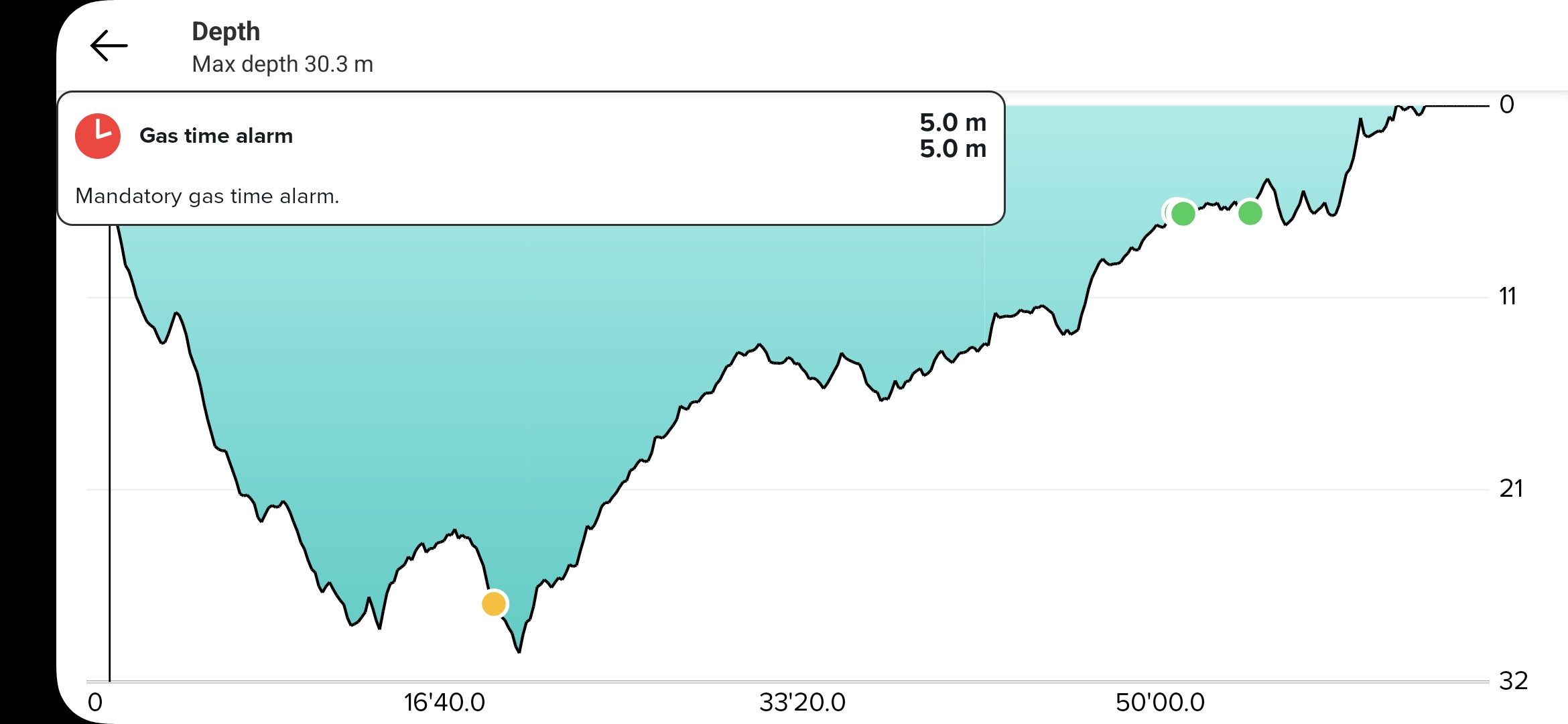
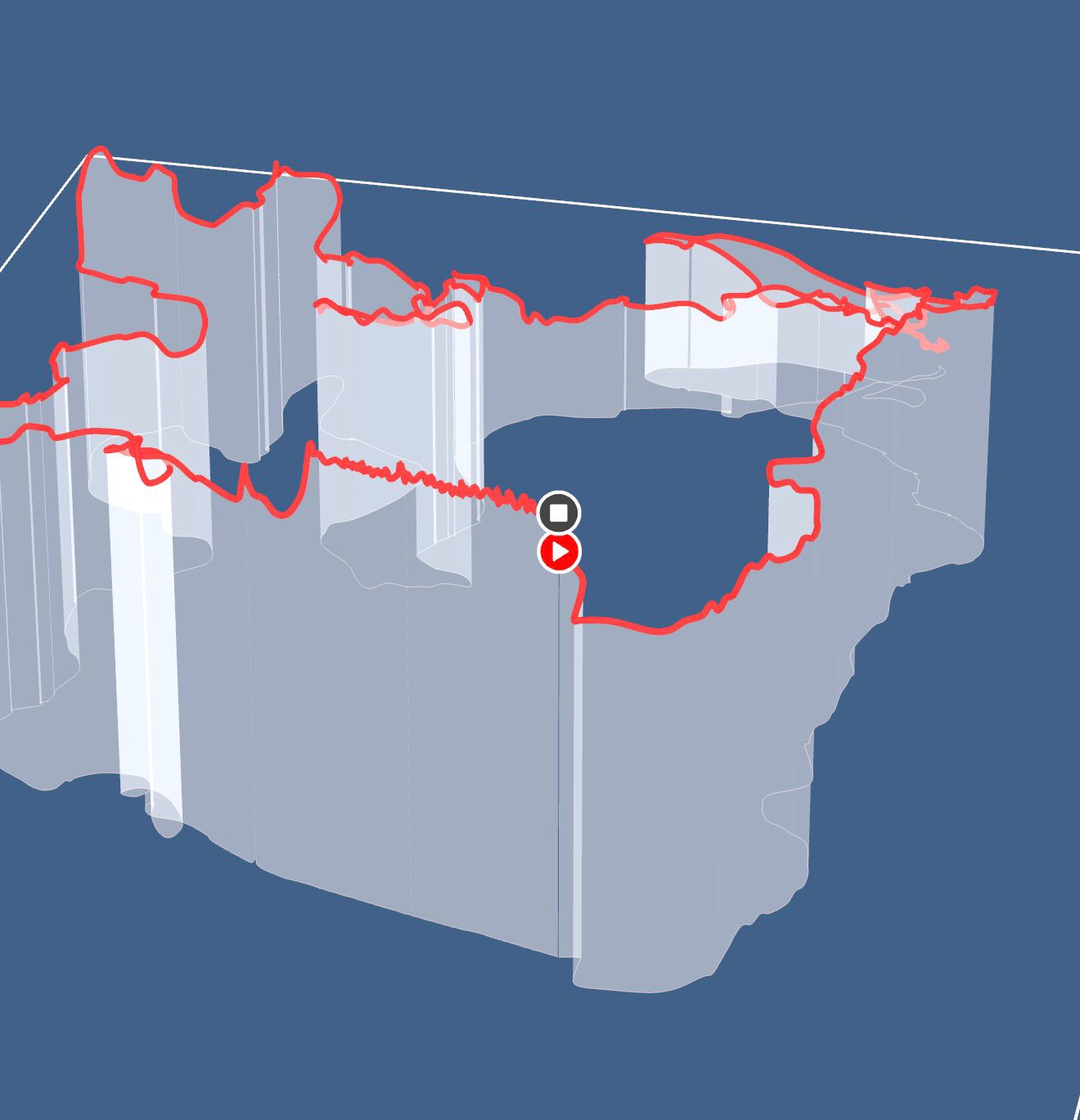
Nevertheless, to be able to appreciate the quality of the restitution, it would be necessary to have other known and fixed elements such as remarkable landmarks (spots with known GPS coordinates for example). In my case, I have entered certain points in my Nautic and it would be good for them to appear on the 2D and 3D map so that we can quantify the errors and give proper feedback to the developers, rather than the simple question from the application, which asks if the restitution of the trip seems correct …
If you need a hand with the GNSS recalculations and the Kalmann filter, I can help if needed.