Suunto Vertical is here
-
@slurpnik I believe that there is a link, but not sure where. If you want just share a screenshot and many people here will be able to help you.
-
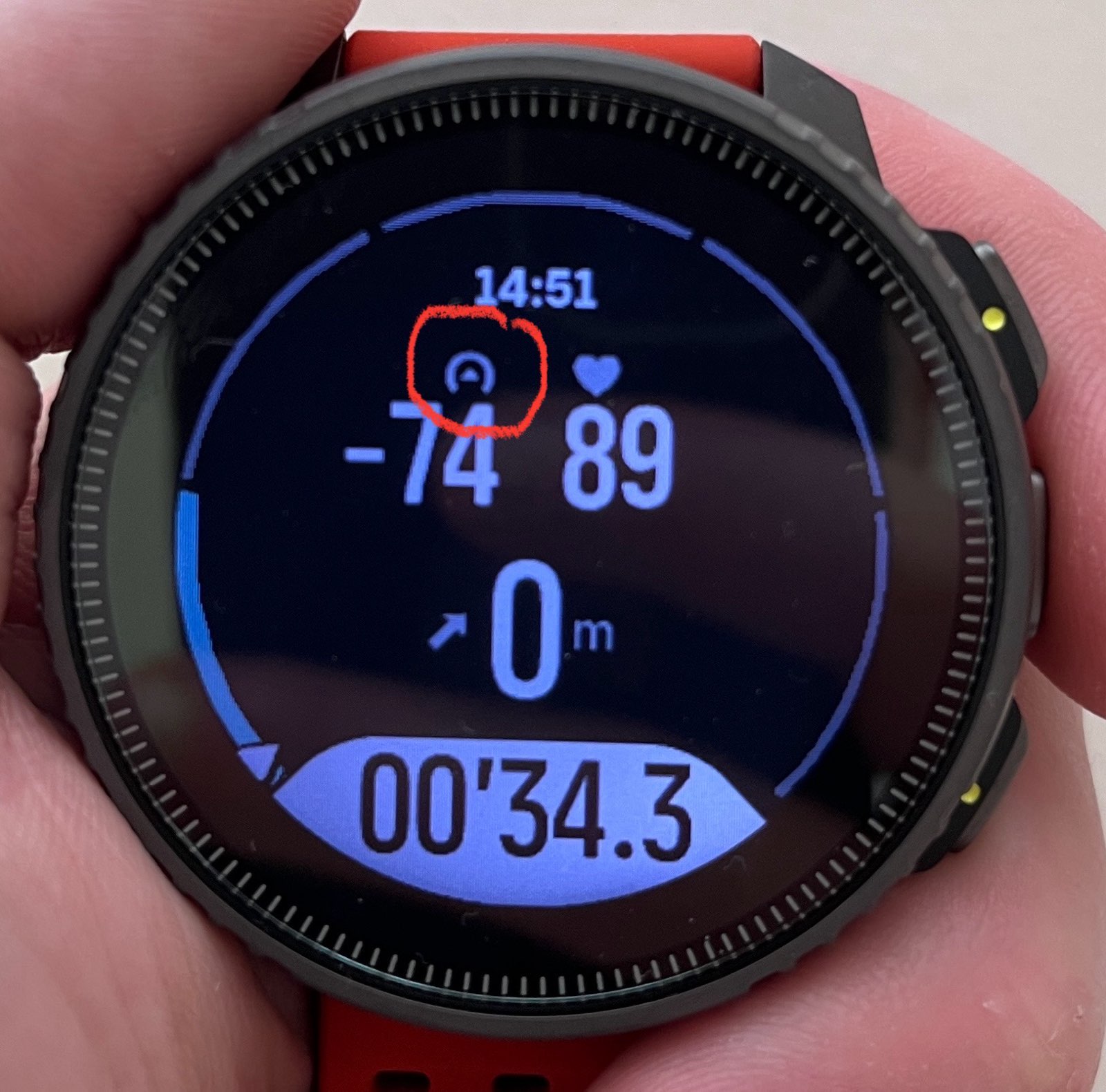
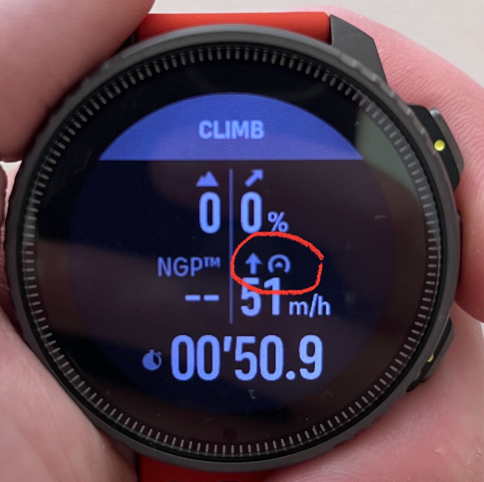
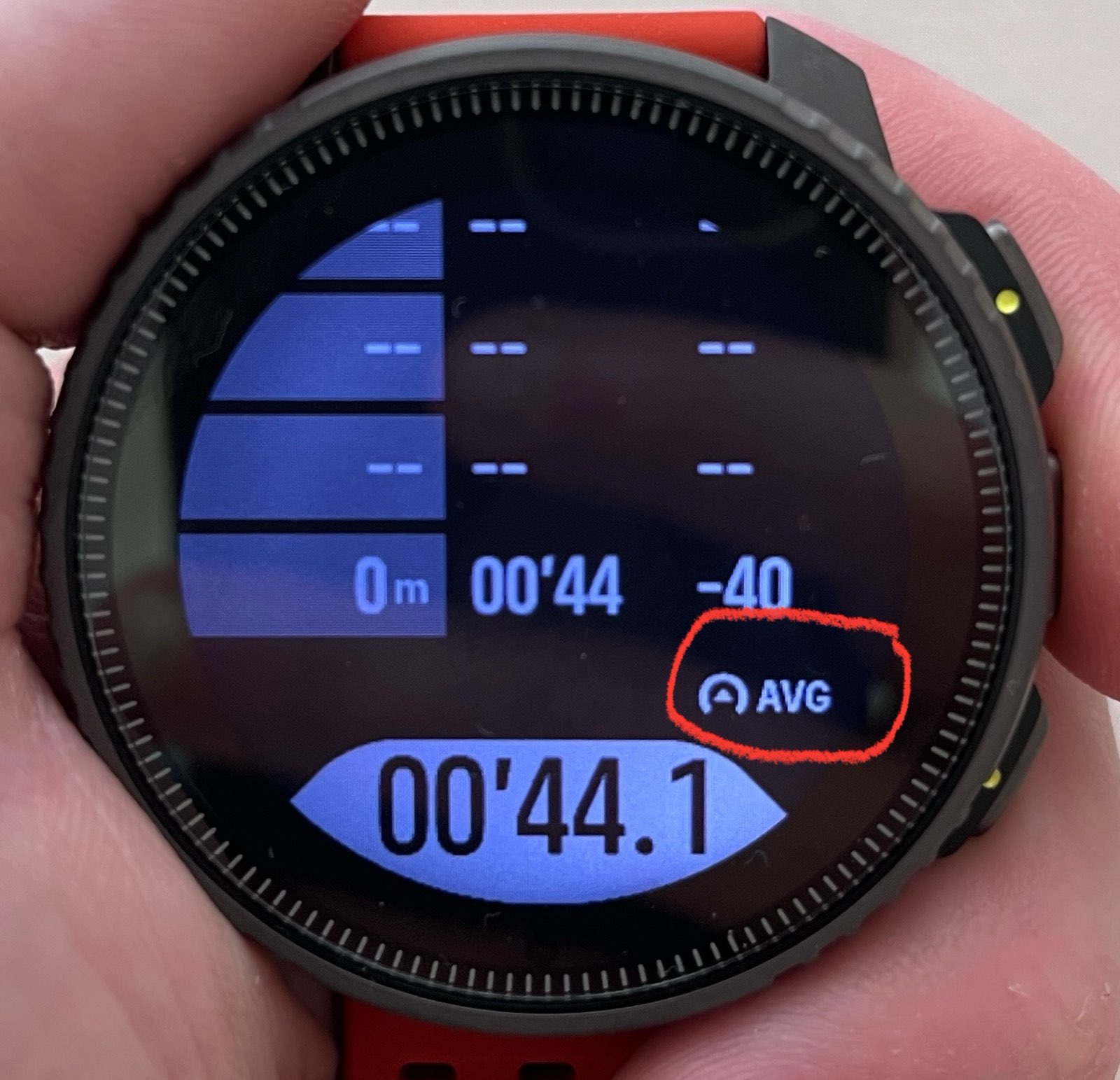
@isazi Thank you, I’m not sure what the triangle inside semi-circle means:


I believe altitude is the mountain icon (but missing any units?), and ascent is arrow upwards icon. Although on one image arrow upwards is in meters (meters climbed?), in the other with % (steepness of the climb?).
-
@slurpnik
It’s the speed icon- instant
- vertical
- avg
the icon can be seen in the sport customization screen in SA
-
@sartoric Thank you! I feel very stupid for asking these basic questions …
Where can I find the icon in sport customization in Suunto App? I am on iOS and haven’t seen any icons associated with fields. And what is unit of speed, m/s or km/h if I’m on metric system? Any idea why instant speed is negative when I’m not moving?
-
@slurpnik
sorry I meant field description (so icon description) -
@slurpnik said in Suunto Vertical is here:
Any idea why instant speed is negative when I’m not moving?
Because while GPS has good filters so that when you don’t move speed is zero, the barometer has not the same quality of filters (also the barometer has to deal with smaller scale than the GPS) so instant vertical speed is noisy when you do not move.
-
@sartoric ah I think I know what you mean. However, these are from the default activity which is not customizable, so I wasn’t able to edit and see the description of the field with icon.
@isazi thank you for explanation. Note that also instant speed (which comes from GPS I suppose?) is negative at -74. If it said something like 0 km/h then it would be clear to me what it is, this way with icon and weird number I was confused.
Thanks again!
-
@slurpnik all fields you posted are vertical speed, not horizontal speed.
-
@isazi
yep …normal speed has the gauge arrow pointing right
… I guess I’ve seen it’s the same as pace now … could it be possible ?
-
@Brad_Olwin Can someone please tell me if the altitude graph is now available on Suunto Vertical Solar watch face (instead of solar graph) ?
Thanks! -
@sebchastang No, solar graph only.
-
@renton82 Thanks. Is there any plan to make it available in the future?
-
@sebchastang I hope so but I don’t know.
-
@sebchastang said in Suunto Vertical is here:
@renton82 Thanks. Is there any plan to make it available in the future?
I don’t know for sure but there’s definitely been talk of it and I’m sure Suunto are aware. Wouldn’t surprise me if they’re working on it for a future update
-
I have 2 questions before buying the Vertical.
1/ Can i do a sports activity with map navigation in all system gps mode? (90 hours) Or only in multiband? (60 hours)
2/ Question about the app: when i upload a course in the Suunto app, the total ascent is always too low. The ascent in Strava is always higher. Map in Suunto app not great?
Thanks for help!
-
@Ultrawalker said in Suunto Vertical is here:
I have 2 questions before buying the Vertical.
1/ Can i do a sports activity with map navigation in all system gps mode? (90 hours) Or only in multiband? (60 hours)
I haven’t tested it but I do not see why not. I do not think they are related.
2/ Question about the app: when i upload a course in the Suunto app, the total ascent is always too low. The ascent in Strava is always higher. Map in Suunto app not great?
Two different things. What watch are you using now? If your watch doesn’t have barometer, and talking about Suunto watches, ascent will normally be less than reality, more noticeably in hilly terrain. If your Suunto watch has baro I would trust the Suunto. But in this case nothing to do with the map in the Suunto App, the Suunto app only shows what the watch has recorded. On the other hand, if you prepare a route with Suunto App probably ascent will be much higher than reality, Suunto is aware of it and from what I’ve read will be solved.
-
@Ultrawalker said in Suunto Vertical is here:
I have 2 questions before buying the Vertical.
1/ Can i do a sports activity with map navigation in all system gps mode? (90 hours) Or only in multiband? (60 hours)
Just Checked, and map is deactivated in all predefined modes except the performance one.
But in custom battery mode, one can select best, good or OK GPS modes, with map activated. -
@cosme-costa said in Suunto Vertical is here:
On the other hand, if you prepare a route with Suunto App probably ascent will be much higher than reality, Suunto is aware of it and from what I’ve read will be solved.
I hope it will be fixed soon.
-
@Wilson75 A fix is coming for this, Suunto collected data and I believe has a path forward. I would imagine it would be soonish and will come as an app update in beta before release.
-
@cosme-costa Using now the 9 peak pro for hikes.
I create my routes not in Suunto app but in Komoot webversion.
When route synchronise in Suunto app the total ascent is always less in Suunto.