Software Limitations of Suunto Nautic vs Garmin X50i
-
After carefully comparing Nautic and X50i, and seems like Nautic has some interesting software limitations.
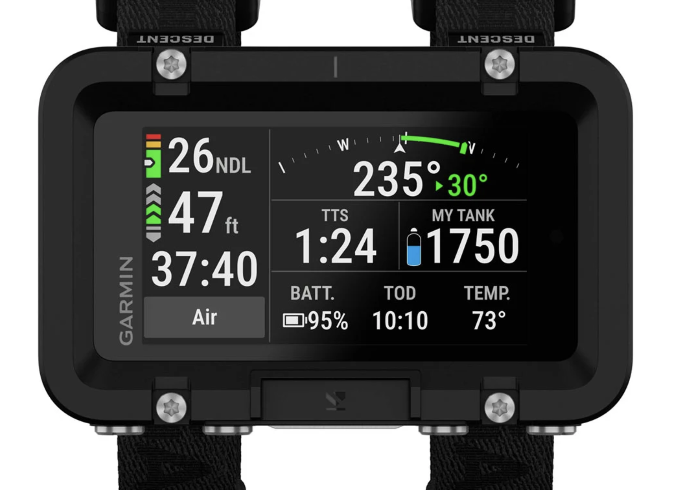
1) No tank pressure when looking at compass:
When I am navigating underwater, Nautic hides the current tank pressure stats. Garmin X50i allows me to see both compass heading and pressure at the same time, despite having a smaller screen. Is Suunto planning to fix this in an upcoming software release?
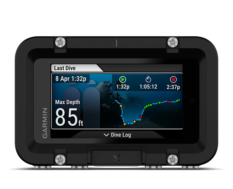
2) No live dive depth chart:
X50i shows a live dive depth chart on screen, which I find quite helpful. Suunto Nautic can generate a 3D dive map AFTER the dive, but does not show a live depth chart during the dive. Also wondering if this is something Suunto might fix in next software release.
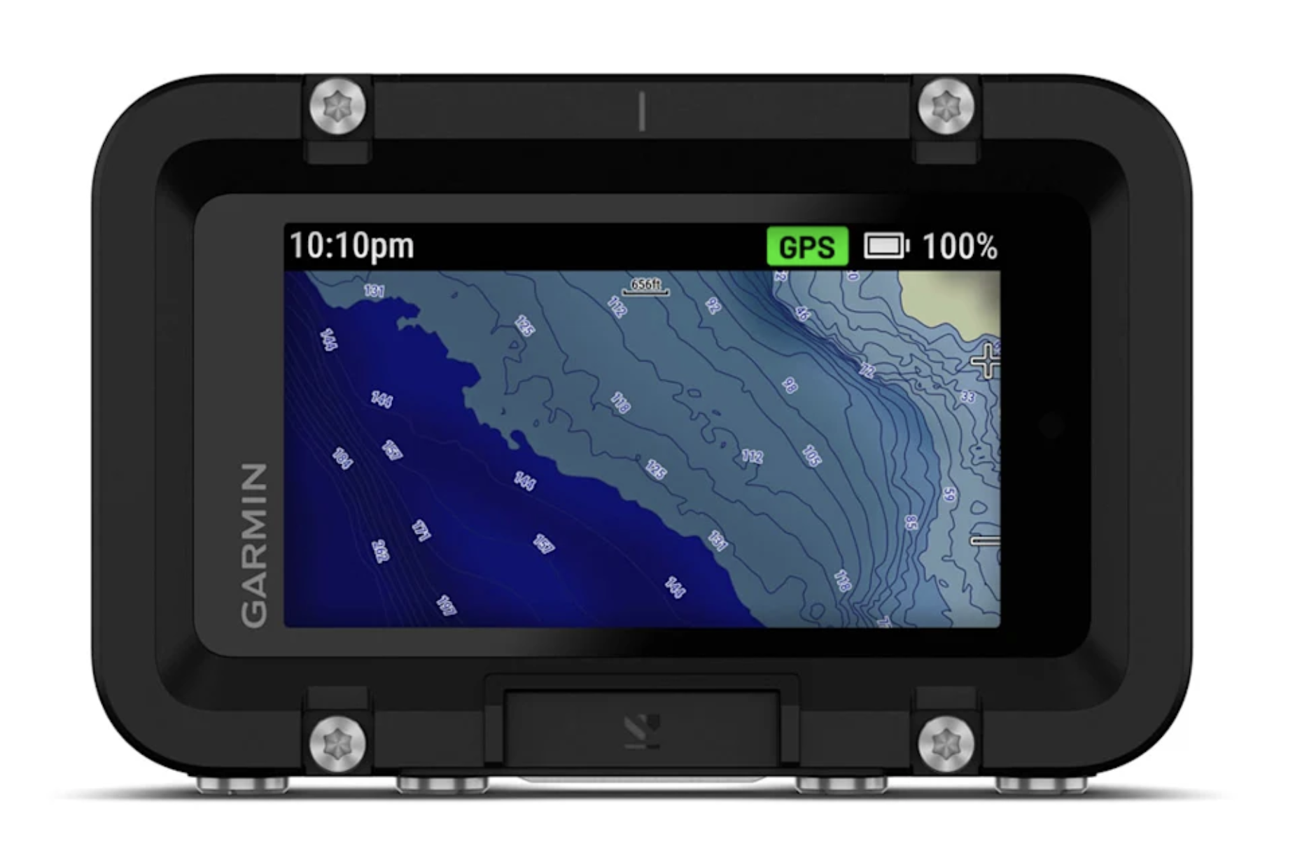
3) No dive topography maps:
I am not going to hold my breath for this feature, because it is a major feature that seems hard to fix with a quick software update. But it would be a miracle if Suunto somehow pulls this off.
It will be super if a representative like @Brad_Olwin or @pavel.samokha can chime in and clarify the plan for software updates.
- Aquario
-
@Aquario regarding the maps you cannot see them during your driver am I right?
-
AFAIK the Nautic only shows the land surface map, not the underwater topographic map.
Plus, the surface map also disappears when the dive starts.
-
A Aquario referenced this topic on
-
Thanks to @Niels-Søren-Bøgh we have two more items for the software wishlist.
4) Missing Tide Widget
Tide widget is mentioned in the manual, but it is not included with the current firmware.
The manual says that “The tide widget provides information about the current tide state. It shows the tide height (m), upcoming high and low tides with height and time, wave height, moon phase, and a 24-hour forecast.”When the tide widget is actually released, I hope it can download data for upcoming 3-5 days. Some remote SCUBA locations don’t have wifi connectivity, so it will be important to have the tide widget not go blank without Wifi. Instead the widget should fall back to 3-5 days offline cached data.
5) Underwater Waypoint Navigation
As suggested by Niels in the following post: color coded waypoints displayed on the compass dial.
Niels’ mock up of the waypoint system:
https://forum.suunto.com/topic/14403/considerations-on-simple-underwater-navigation
An implementation of waypoint system on Apple Watch compass app:
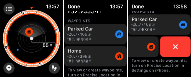

This will require sensor fusion, but if implemented this feature will be a godsend for underwater navigation.
-
Sorry, wrong topic… please remove post.
-
Tide widget is coming on next FW Update. Estimate during January
-
Dive topography maps would be an excellent feature!
Could be displayed full screen during a dive by long pressing one of the Nautic four buttons, and replaced after a few seconds (configurable in settings), or in case of an important notification (tank pressure, stops, …).
With GPS + underwater waypoints navigation, it would make a perfect combo.
-
@el.Fakir dive topography with an overlay on the Maps application so you’re able to set your baring on the compass before the dive. I’m Sold…
-
Teleportation bug:
User @el.fakir caught a good bug in the dive plan: Suunto Nautic does not consider ascent rate in its calculations.
Following screenshot red highlights that Nautic assumes instant teleport from 36m to 9m.
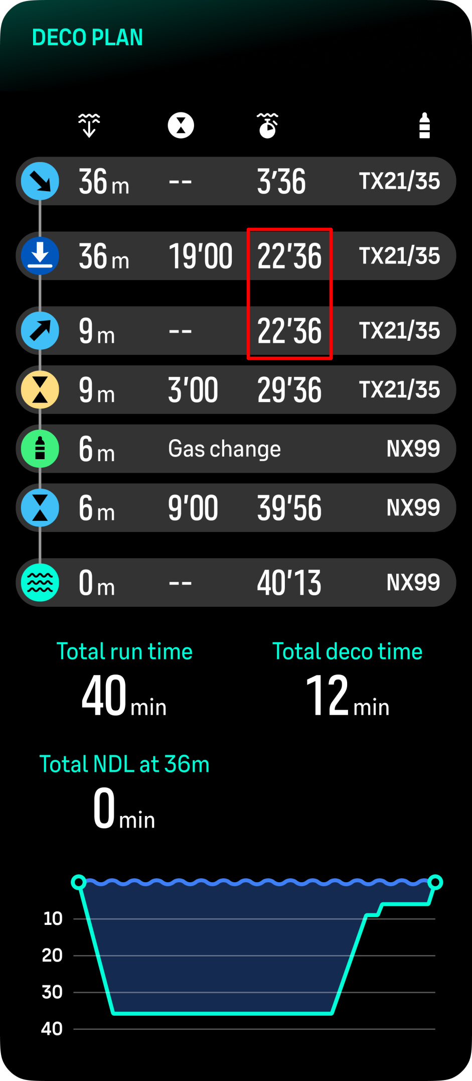
Link to original post: https://forum.suunto.com/post/184204
-
@Aquario All good fixes that need to be addressed. The biggest issue that I currently have is that I wear my Nautic on my left arm and the button orientation reverts to right-arm orientation after the computer shuts off. I was promised that this bug would be fixed with the first software upgrade, but it wasn’t. I’m considering returning it.
-
@mitchellrishe This is fixed in the update from Feb 13th.
-
User @divingpassion discovered that the tank pressure disappears under 30 bars. if you go below 30 bar, Suunto Nautic shows 0.0 minute gas consumption remaining.
Source: https://forum.suunto.com/topic/14751/showing-bar-below-30
Hello! It looks like you're interested in this conversation, but you don't have an account yet.
Getting fed up of having to scroll through the same posts each visit? When you register for an account, you'll always come back to exactly where you were before, and choose to be notified of new replies (either via email, or push notification). You'll also be able to save bookmarks and upvote posts to show your appreciation to other community members.
With your input, this post could be even better 💗
Register Login