Map updates
-
@isazi said in Map updates:
@Mitch9 said in Map updates:
More than two months ago the SV is released. Until now I have no idea how map updates come to my watch.
As far as I know, they don’t. Today when a map is updated (it happens) you need to know, delete and download it again. This will change in the future.
Because this topic has been recently referenced, this has changed in the year that passed, and when an update of the map is available it is downloaded when you charge your watch (in wifi range), there is no need anymore to delete and reinstall maps.
-
@isazi
nice info, thanks.
Does it give any information of that ? Map version/date ?
Given that : we don’t charge watch so often (2/3 weeks ), and charge is quite quick (
  ) and map download is quite long (
  ), how many weeks would one need to have all maps updated ?
you have 2 hours to dissert on the topic 🥳[edit] add to the problem that if you charge out of home or out of your normal wifi range, you might loose one chance of updating

-
@Mff73 they are not updated that often I believe, it happened for zoom increase once, it also happens to fix map bugs (some of them reported in this forum).
BTW updating maps is a cost for Suunto (network/storage/CDNs/etc) so this is something that is done when necessary. -
@isazi
i am not complaning. I may not have read your comment properly : rodger the fact that no need to delete a map to “update”.
Is there “still” an information in the app, that map(s) need/can be updated ? And not the maps silently updated when charging (which primarily i understood from your comment (sorry)) ? -
@Mff73 yes if you look at the downloaded maps you see that the updates are already in the pipeline to be downloaded again. As far as I know you do not get any popup or information, you need to go to downloaded maps and you see it there.
-
@isazi said in Map updates:
@Mff73 they are not updated that often I believe, it happened for zoom increase once, it also happens to fix map bugs (some of them reported in this forum).
BTW updating maps is a cost for Suunto (network/storage/CDNs/etc) so this is something that is done when necessary.Why specify that it is a cost for Suunto? All updates for everything always costs money in hardware, bandwith, storage, CDN, and so forth… Kinda a weird thing to specify.
And for a company the size of Suunto, which probably uses AWS or Amazon CDN’s for distributing these types of updates, the costs will be very, very, very small, barely neglieable. I have worked as an architect in AWS and Azure for many years, and if the staging and distribution pipeline is done right, then the costs will be minimal.
-
@neonix I am always happy to read, how experts tell Suunto how they should do their job

-
Hello,
I see a disscusion about maps…
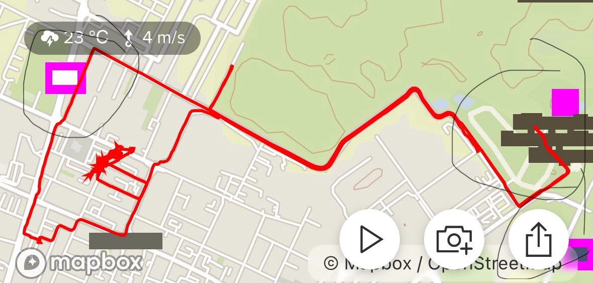
What are this rectangles and shapes? I run a lot of time in this area and it’s first time when I see it.
Thanks
-
@Egika said in Map updates:
@neonix I am always happy to read, how experts tell Suunto how they should do their job

Where did I tell them how to do their job? I just talked about costs for CDN’s and bandwith are neglieable for large corporations, so why even mention it in a forum thread…
-
@Bogdan1921 This might point you in the right direction:
https://github.com/mapbox/mapbox-maps-ios/issues/978Looks to be an issue between Mapbox rendering and iOS.
-
@Todd-Danielczyk
Thanks

-
Need contour lines back. It’s a bit problematic when I can’t use it over 200m.
-
How did we get an increase in map scale zoom without an update to maps? I thought the onboard maps were all image based, so wouldn’t we need new imagery for those zoomed out views? Clearly I don’t know how the maps work…
-
@duffman19 there are map tiles stored in the watch. And it is not just images, it is data that needs to be interpreted by the watch for rendering.
if you zoom out, more tiles need to be rendered with less resolution to fill the screen.
-
@Egika Gotcha. I think the last zoom update came with a map update, so I was hoping for one this time around as well.
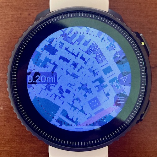
I will say that Suunto did well with their large scale zoom renderings, eliminating minor roads to maintaining a clear and legible map. However, the closer zoom ranges, for me, are sometimes a bit crowded. Service roads, such as driveways and parking aisles, are rendered with the same color and thickness as roads. This causes some tightly packed renderings creating some rather messy looking images, especially in residential or commercial areas that have been micro-mapped. Maybe those minor ways could be toned down in the future?

-
@duffman19 wow, that looks crowded.
but maybe not the default terrain for in-watch navigation anyway… -
@Egika said in Map updates:
but maybe not the default terrain for in-watch navigation anyway…
Indeed. The Suunto maps are my favorite for trails in less dense, open spaces.