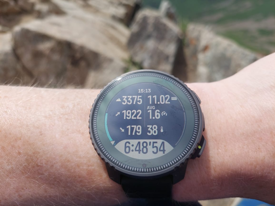
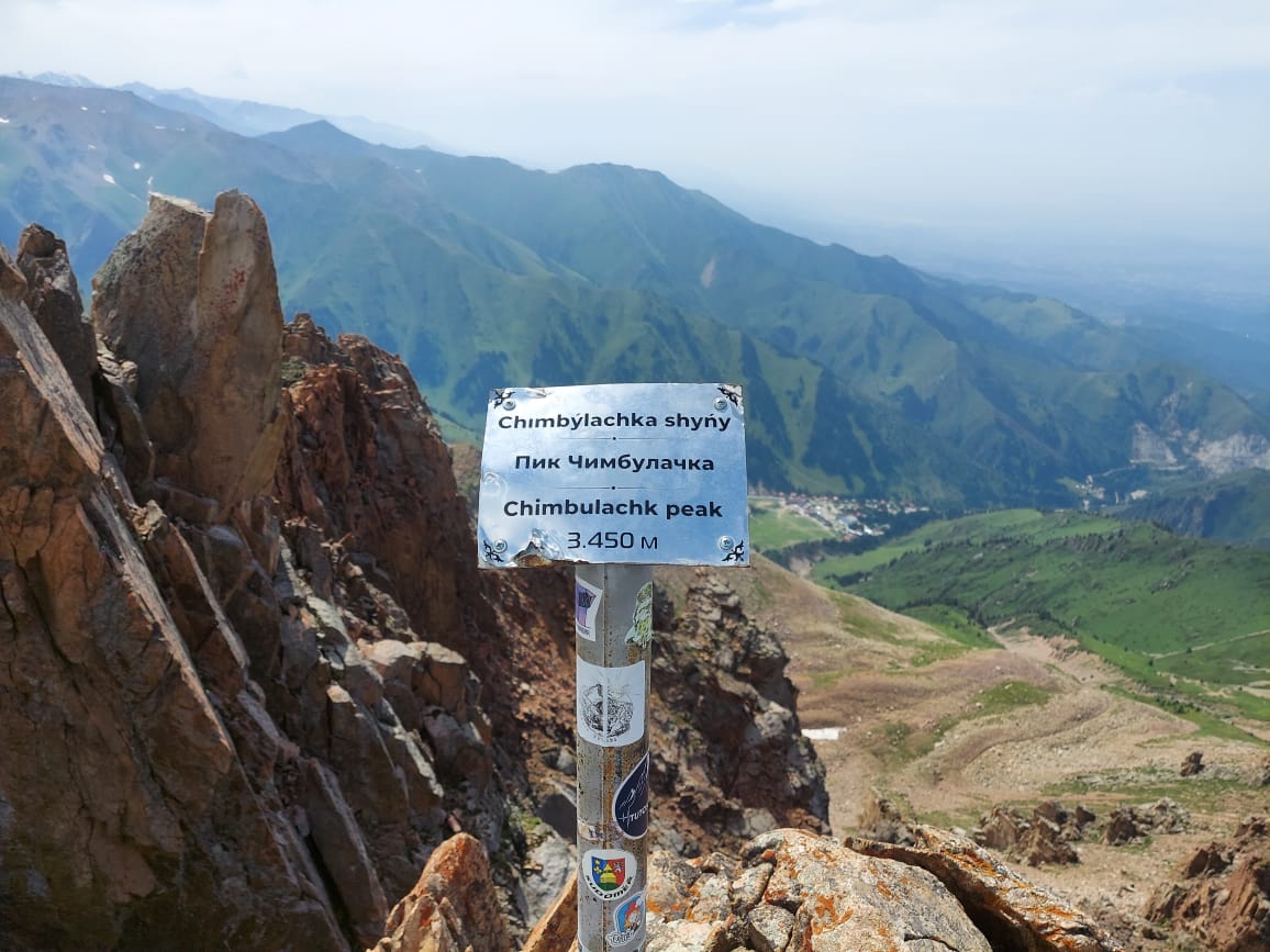
Altitude incorrect while hiking
-
@freeheeler Should I or the SV check altitude throughout the activity? Doesn’t SV know GPS altitude, especially in dual-band GPS/GNSS?
-
For me the height accuracy of the SV is really great in the mountains. Mostly within 10 m for peaks which is amazing for such a device. Sometimes I calibrate the height (when the situation is right for it) but not always.
-
the accuracy sometimes depend on the location. some mountains my SV show higher and some mountains show lower altitude at the peak. so far within 20 meter range.
maybe the altitude shown on signboard at the peak doesn’t accurate as well. you can double check on the TOPO map. -
My sv altitude is always very close on 1000+m mountains usually within 10m. I don’t calibrate it or anything before starting I just let it run
-
@Sergei-Ladeishchikov did you manually set elevation prior to the hike?
-
@Łukasz-Szmigiel
that’s not necessary but doesn’t effect either -
@freeheeler I’ve read somewhere around the forum that if you set elevation manually prior to the workout it can disable fused alti for some time.
-
@Łukasz-Szmigiel
yes that was true until a date we can not tell anymore because it’s unknown
I did a test recently and it was confirmed by others. you can do what you want and when you want with manual calibration, FusedAlti will correct it anyway if necessary
-
@freeheeler cool, didn’t know about it, thanks.
-
@Łukasz-Szmigiel I did not set the height, the FusedAlti had to set it.
-
@babychai All the maps show the same height - 3450 m. Either my FusedAlti was blocked at the beginning of the trip, it was blocked due to and did not work during the trip, or FusedAlti did not work at all. 1/3 of the trip was forest, the rest mountains with open space.
-
@Sergei-Ladeishchikov
Was the track ok ? Maybe there was some GPS reception issue -
@sartoric Yes, the track was ok, total ascent was correct, too. I compared with this route.
-
did you go into water?
this is a huge difference
-
@Dimitrios-Kanellopoulos I did not go into the water, and there was no rain.
-
@Sergei-Ladeishchikov I understand the other device was showing even lower altitude? That means with even bigger error?
Maybe this is a mapping problem and the actual GPS altitude is lower than on the sign post? -
@Egika another device (garmin) showed 3425 m. There were several peaks on my route, and everywhere there was a rather large difference down.
-
@Sergei-Ladeishchikov I am with one of the first replies: Let’s find out, if this was a one-time glitch out of whatever reason or if it persists.
What we can confirm is, tha FusedAlti is supposed to work also in Endurance or Custom battery modes. -
How often does Alti need to calibrate altitude? at the start of the activity? during activity?
-
@Sergei-Ladeishchikov as stated before: It tries to calibrate during the beginning of the activity. It usually takes 12-15mins which will then correct the recorded altitude backwards from the start.
Right now I am not sure if the watch will try again if it fails after the first 15min…

