Snap to route did not work on route that crosses itself
-
Today I ran the Amsterdam Half Marathon, and previously I had noticed that GPS reception on this track can be pretty bad, because of the built up environment inside the city.
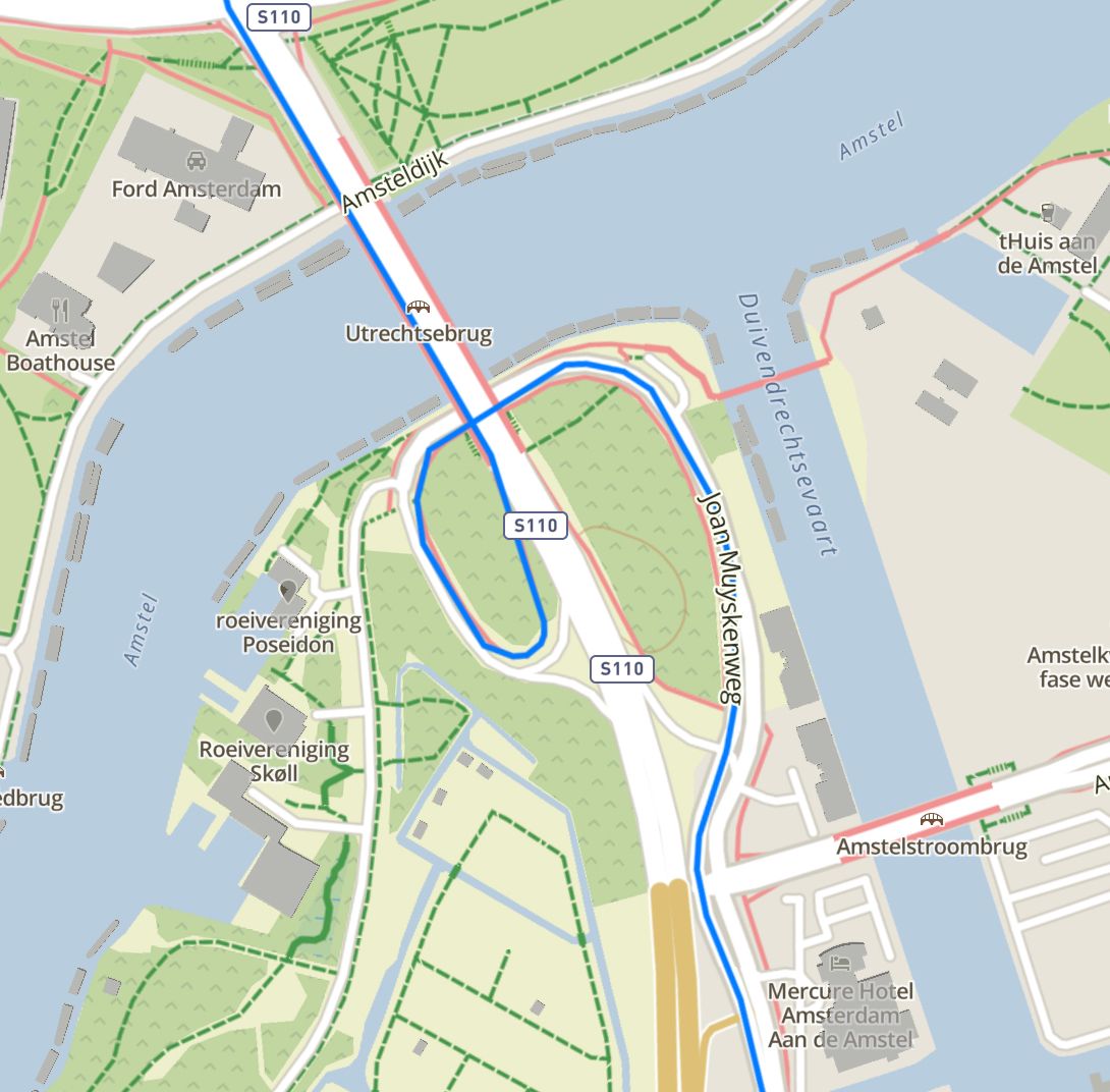
So this year I drew the route in the Suunto app, uploaded it to the watch, and used ‘Snap to Route’. Which worked great on the first couple of kms, which are built up. But once you leave the city and there’s a more or less open sky, there is also a loop where you descend from the route, run through an underpass, and continue on the road on the other side.
The recorded track skipped this loop completely, instead drawing my route straight over the motorway.The loop isn’t really that tight, and view on the sky on this part should be OK (except for the underpass of course), there are some trees and some buildings, but nothing major. I was quite disappointed by this inability to follow the GPX track, I was hoping ‘Snap to Route’ would track my race better instead of worse.
Track as drawn in the Suunto app:

And track as recorded by the watch:

-
@Soylent-Yellow
what was the battery setting during your race?
I recall that the watch ignores snap to route if it locates a point too far off the actual route. maybe the turn was too sudden.
I once saw perfectly nice recordings of several rounds on the 400m track, but the radius is relatively big. -
@Soylent-Yellow very strange, I did test snap-to-route under bridges.
-
@freeheeler Battery settings were the default, so that would be Performance. No need to set it to anything else a short race. GPS was set to GPS + Galileo.
-
@isazi So it’s looks like it just had a moment of bad luck with the watch, this should have worked fine.
Well, I will be using snap again in 2 weeks time, during the NYC marathon. Thhe route has a really tight loop where the Queensboro bridge connect to 1st Avenue. That will be a real challenge.
Plus I will be running the green route, starting the lower level of the Verrazano bridge. Doubtful if I’ll have any GPS reception there.
As an aside, do you have an idea wether the way you set up the route to follow will influence the snap accuracy? Does the algorithm snap to route, or does it snap to points?
I always like to make my GPS tracks as clean as possible, and use Adze to remove superfluous points. This reduces the size of the GPS track, and I always assumed that would be easier for the watch to handle - more straight interpolated lines, les points to interpolate between. But maybe it would be better to have more points, and shorter interpolations?
-
Snap to route is supposed to actually follow the planned route, even if it crosses itself. It is a little more than just snap to the closest point wherever you are.
Your additional step to do whatever to the route with this tool - I would start looking here.