Fix the elevation issue in Movescount
-
When a route is created or imported into Movescount it does not show the elevation either in Movescount or on the watch when the route is transferred to the watch. This is apparently an issue with the MapBox map provider. It only affects legacy watches like my Ambit Peak 3. I was told a year ago by Suunto support that they are working on a fix and was told the same thing this morning in a chat session with them. The cynic in me says they have no interest in fixing this fault so those of us with older models of watch buy new ones

Why not use a different map provider?? -
( or you can save some time and skip going through old threads, just switch to something like Plotaroute for route planning, once you have imported those to Moveacount and synced to your watch, you’ll have elevation profile )
-
@margusl said in Fix the elevation issue in Movescount:
Plotaroute
@margusl thanks for your reply. I’ve tried creating routes in different software, e.g. plotaroute and MemoryMap - there is still no elevation data when I import them into Movescount.
-
@tim-shiles Did you also check the synced routes on your Ambit? Elevation profiles that do not show up in Movescount can still make it to the watch.
-
@fenr1r yes, I can import them to my watch but there is no elevation data for the route on the watch.
-
@tim-shiles Curious. I just tried with two basic snap-to-track (By Foot) routes in Plotaroute (via FF), both exported GPX-GPX-Route … one with Directions, one with POIs. I didn’t change anything in Plotaroute or MC: just imported, toggled watch use and saved. Resynced (SL 3.4.5) and both appeared on my A3P with altitude profiles.
Did you do anything more interesting than that?
-
@tim-shiles said in Fix the elevation issue in Movescount:
@fenr1r yes, I can import them to my watch but there is no elevation data for the route on the watch.
How did you export your GPX from Ploataroute? GPX type: track, not route?
How long are those routes you tested with? if you are importing routes with more than 1000 route points into Movescount, those will be simplified, I haven’t actually tested if this strips elevation.
You can actually check if route in Movesoucount still has elevation data - add few POIs, if elevation field of a POI is set, your route should be fine and you should have elevation plot on the watch.

-
@margusl I have tried importing routes and tracks from plotaroute and MemoryMap. They import into other apps OK, e.g. OS Maps and Strava, with all elevation data, but:
-
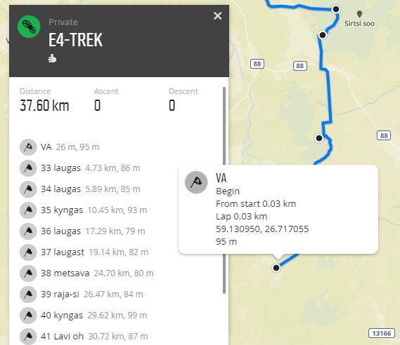
Movescount used to show the elevation of each waypoint, but not the ‘Ascent’ and ‘Descent’ totals:

The elevation data would then appear on my watch after I had transferred the route to it. -
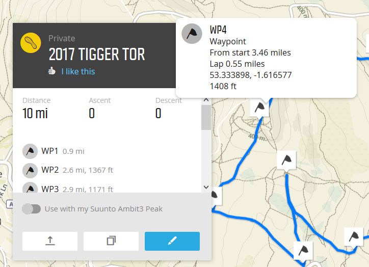
But it no longer shows the elevation of each waypoint:

Suunto support have said this is a known issue which is caused by the MapBox map provider which Movescount uses and they are working on a fix, but it’s now been over a year…
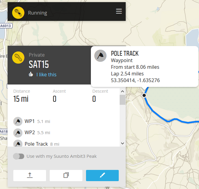
I see the route in your screenshot is also missing the total ‘Ascent’ and ‘Descent’ data.
-
-
@comfortably_numb said in Fix the elevation issue in Movescount:
I see the route in your screenshot is also missing the total ‘Ascent’ and ‘Descent’ data.
Of course - no one here is arguing that Movesount route view is not broken.
But for imported and older (pre-2020Q1) routes that’s just a piece of presentation and has been like that since Mapbox retired its Surface service about a year ago. Why have they decided not to calculate Movescount route asc / desc totals from data already included in the the route, I don’t know. Luckly it has no effect on how routes with already exiting elevation data are synced to the watch.As your No.2 route / SAT15 clearly lacks elevation data, it must be come from somewhere else than Plotaroute.
You could also just export your routes from Movescount as GPX and check if elevation is set for routepoints (route created with Plotaroute, imported to Movescount):
<?xml version="1.0" encoding="utf-8"?>
    <gpx version="1.1" creator="Movescount - http://www.movescount.com" ...>
       <rte>
          <name>ExpEst2020</name>
          <rtept lat="57.8374105" lon="27.5755725">
             <ele>69</ele>
          </rtept>
          <rtept lat="57.8373528" lon="27.5802755">
             <ele>64</ele>
          </rtept>
          <rtept lat="57.8375673" lon="27.589674">
             <ele>52</ele>
          </rtept>
If
<ele>elements are there, you’ll have your elevation plot on the watch as well.In contrast, this is how routes created with Movescount itself (i.e. without elevation data) will look like:
<?xml version="1.0" encoding="utf-8"?>
<gpx version="1.1" creator="Movescount - http://www.movescount.com" ...>
   <rte>
      <name>Umbusi-Pikknurme</name>
      <rtept lat="58.551599" lon="26.034306">
         <ele>0</ele>
      </rtept>
      <rtept lat="58.569967" lon="26.019074" />
      <rtept lat="58.570068" lon="26.019128" />
      <rtept lat="58.570247" lon="26.019728" />
Don’t know about OS Maps, but I’d expect Strava to apply its own elevation model once a GPX route is uploaded, like it does with activities when imported from GPX files lacking elevation data.