-
I’d like to roll up this ancient topic if I’m allowed to…
but with a somehow different basis of the question to you folks.
Did you ever notice that all your start altitudes that you start from a known point differ by several meters? My frequent starting alti is on 424m.
My activities sometimes show 404m on the graph up to 449m. But usually around 416m, hence 8m too low.I know that FusedAlti kicks in after something like 15minutes but I remember that it changes the graph backwards in order to not only correct the altitude but also correct a potentially wrong start altitude, am I wrong?
What is your experience?
-
…and while I’m already asking…
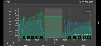
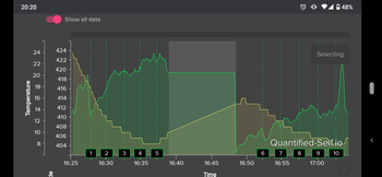
I went for a short ride along the lake (which is supposed to be a flat track) and I went to a shop (5th floor) while I paused my activity and later I found the following on the alti graph recording… I’ve restarted the activity exactly where I’ve stopped it some minutes before.
-
@TELE-HO temperature influence. That has not Todo with correction. If you stay inside it will get wrong gps altitude and temperature will be increasing or falling changing the altitude. That is why 20meters chnaged
-
@TELE-HO fused alti does not work only in the first 15 minutes. This is chnages quite some time ago. It will try many times and additionally constantly correcting the altitude
-
@TELE-HO I have never seen it correcting it from the start. Sometimes it takes 20-25 minutes to kick in and then I see the altitude gradually being corrected in the next few minutes.But the beginning of the activity still contains the wrong altitude.
-
@surfboomerang you cannot see the correction of the altitude.
There is the initial offset adjustment that you don’t see and after that during ie if the pressure chnages and it does not align with the altitude then it will gradually correct it.
Note: -+10-20meters will be corrected slowly not fast during the activity not on offset.
-
@TELE-HO in your specific example the correction happened when you existed the store most probably. Should not happen so much , and mostly it trusted the temperature.
The fused alti is not designed so well for indoor and floors etc when gps is on (no indoor activity)
Alternatively you could do multisport to indoor move and would help.
-
@Dimitrios-Kanellopoulos
you mean this:

The track should be flat, but it is slowly corrected to (almost) the right altitude in the end.
-
@Dimitrios-Kanellopoulos
you mean it still wants to correct, even when paused? -
@surfboomerang yes but even if you had the altitude at start at 1000m the same chart could happen.
At start it would calibrate immediately to let’s say 10meters and slowly go to 0. So initial calibration error would be 10meters (just en example)
Also the flat at NL (I have sometimes same charts) is not always so flat (or everywhere).
For example my house is at -10 while at 5km I am at 0 (sea).
However this is going to be improved for those 10meter variations. That line will go correct much faster for flat runs.
10meters is very small error but it shows well if you do not live in a mountains area.
-
@TELE-HO correct. Also in the prestart screen it will do it. Sometimes even if you just turn on the gps for 1min if it can.
Prestart is when you see the start and wait for the gps lock
-
@Dimitrios-Kanellopoulos said in Suunto 9 FusedAlti not remembered after activity:
temperature influence
this is temperature influence, alright. I’ve learned something new.
Then we also need to be aware of changes e.g. when we start a hike with a shirt in the cold and put on a warm jacket and gloves that heats up the watch body and sensor, right?

-
@Dimitrios-Kanellopoulos said in Suunto 9 FusedAlti not remembered after activity:
10meters is very small error but it shows well if you do not live in a mountains area
true! don’t get me wrong, I just want to understand and learn since I observed this behaviour
-
@TELE-HO temperature will influence more when there is no pressure change or if you are “static”.
No it won’t influence asap.
You should not worry about it at all. It need sharp change.
However, if your sensor is dirty yes it will. Not because of the algo or the component but rather of the debris that will do a systolation or diastolation and move the component (sensor).
-
@Dimitrios-Kanellopoulos
interesting stuff and nice to know
in general: we shouldn’t worry too much. -
@TELE-HO about temp yes. Only if your sensor is bad. In general you should also not worry about a watch and a few meters difference if it works ok mostly. That is a personal advice.
-
@Dimitrios-Kanellopoulos Also in the prestart screen it will do it
This is super interesting. So if I wanted to get the best altitude reading I should get to the pre-start screen outside OR at least wait a bit before starting my run?
Usually I will start it inside my home to get a HR lock, then head outside to tie shoes and get on with it.
-
@stromdiddily said in Suunto 9 FusedAlti not remembered after activity:
This is super interesting. So if I wanted to get the best altitude reading I should get to the pre-start screen outside OR at least wait a bit before starting my run?
Yes

-
@stromdiddily explain to me what benefit the <10 meters precision will give you during your activity and I will answer.

 (Joke but also a bit interesting question for my understanding )
Ok i ll answer: yes you can stay static in open space and it will be better. Be that be in prestart screen ? During a pause ? During the activity ? It doesn’t matter anymore. It will do it perhaps better due to being static and facing the sky not wobbling at the side of your body with a great shadow of your body covering 50% of the horizon.
-
@Dimitrios-Kanellopoulos said in Suunto 9 FusedAlti not remembered after activity:
explain to me what benefit the <10 meters precision will give you during your activity … Joke but also a bit interesting question for my understanding
OK, for me, rather than @stromdiddily:
Case 1:
Imagine you are in a place where there are no tracks but identifiable “summits”. A plateau, or moorland, say.
Imagine reliably-surveyed maps have identified and differentiated points of elevation to within that 10m precision. In fact, down to 0.3m precision.
Imagine you do not want to wait for the watch to display your location (and are running another S+ than SAFE) in coordinates and relatively slowly locate yourself on the map that way.
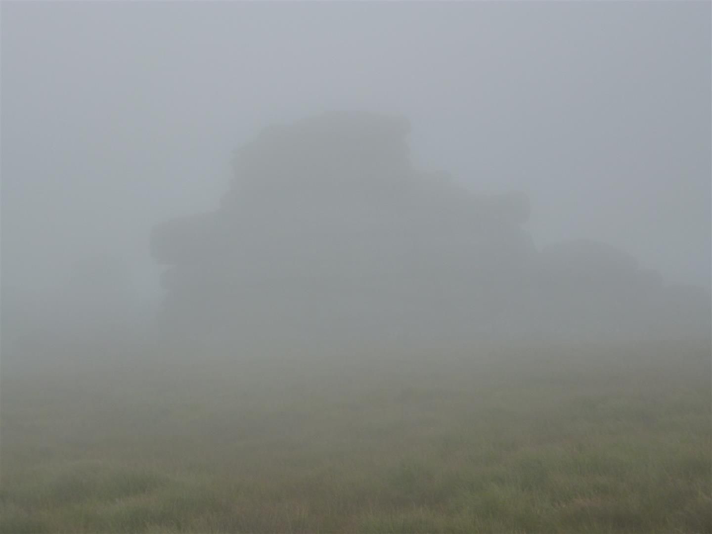
Imagine visibility is this (high summer, 11:15, around 30m to the lumpy silhouette):

And you don’t recognise those particular rocks but know they’re at the top of a hill. Your altitude (and your course) give you your precise location.If there are different heights, the top of whatever rise you’re on is likely “HIll 632” or whatever. NOT “Hill 633”. The less visually dramatic equivalent of a peak. That is a fast enough location fix that you don’t have to break stride. Your altitude (and your course) give you your precise location.
Case 2:
Following contour lines to bypass a cliff, watercourse or other obstructive feature otherwise obscured from view. With an accurately-surveyed map, the altitude precision saves wasting energy when you need to conserve it.
