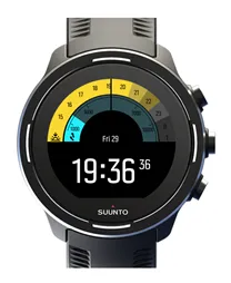
Software update 2.12.30 Staged Release for S3/S5/S9
-
@inkognito (& @Efejota) Interesting. And fine (uncredited-as-initially-displayed-the-shame) map. How would you then use those one-time generated coordinates? Would you be doing this with sequential major features along your route JIC the road became impassable?
If the watch can hold onto a first bearing, without needing to overwrite it with the second, I’d quite like it to be able to save that first bearing … and entered distance … and maybe elevation … maybe with an icon … and a name …
-
@chrisc92 said in Software update 2.12.30 Staged Release for S3/S5/S9:
@Fenr1r near the castle 51° SE (reverse bearing of the tent from the castle = SE 51°) . Please follow with attention

could you share coordinates to avoid visit this area
 ?
? -
@Mff73 Not on any map, apparently - so no coordinates. And the satellite image resolution of the region seems to be measurable in kilometres. I asked a Cure fan of my acquaintance and she told me it’s in the wooded hills above the small village of Dontgonearthe.
-
@Egika Hell! You are absolutely right! I started a whole useless discussion! I missed the degrees bearing… Another reasons for asking for bigger fonts for people over 50

-
@Efejota said in Software update 2.12.30 Staged Release for S3/S5/S9:
Another reasons for asking for bigger fonts for people over 50
Preach.
-
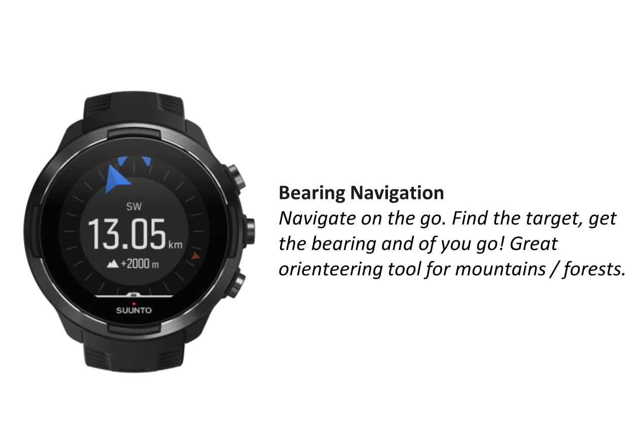
@Fenr1r When it comes to priorities, I would suggest to Suunto something like this:
- Implement the functionality to create POI with given GPS coordinates and elevation straight from the watch… Come on, this is a must!

- When it comes to the current bearing functionality, if you enter distance (and possibly also the elevation), allow us to save that projected point as POI…
- When you use the current bearing functionality without entering the distance, show the ray/line representing that bearing from the position of measurement in the navigation screen… This would come extremely handy if you go zig-zag in the forrest etc…
- If all that is implemented, now it’s a time to possibly implement crazy ideas like mine with the POI creation based on bearing from two different places

- Implement the functionality to create POI with given GPS coordinates and elevation straight from the watch… Come on, this is a must!
-
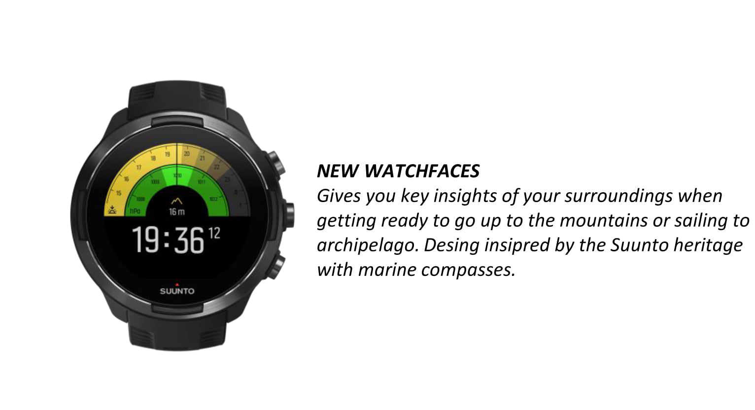
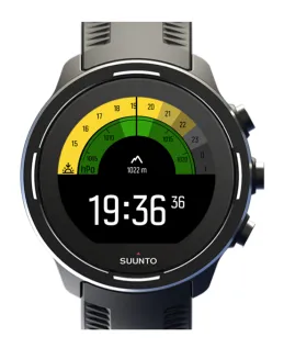
Some feedback about the baro dial on the watch face:
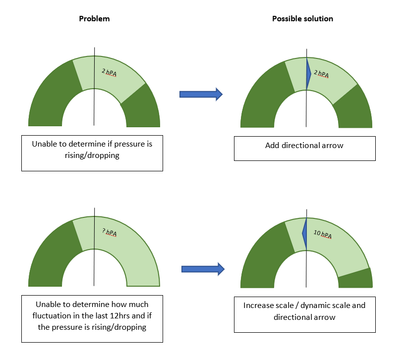
The idea to color the scale light green to show the min/max value is great! The dial however shows about 5 hPa over the full scale. I noticed the min/max values are from a 12hr period. In this period it is not very uncommon that the pressure rises or drops more then 5 hPa. This means that I only see around 2,5 hPa lightgreen and the rest exceeds the scale. This gives me no idea how fast the pressure is changeing.
I would propose to extend the scale to at least 10-15 hPa or a dynamic scale and the direction towards it is moving.
Some pictures to (hopefuly) clarify the text above.
-
@inkognito I heartily agree with the sense and obvious profitability of those suggestions (might even have suggested the first 2 a while back). However, your no.3 has me reassessing your no.4. And your motives. Are you planning to steal something from this hitherto unknown castle, approaching as close as possible to a pre-identified line of unobserved ground, followed by helicopter extraction? And is there a sport mode for that?
-
@Fenr1r For that I am planning to use modified Cheerleading sport mode. I believe it will work great as a cover-up

-
@inkognito Solid. Just don’t snag your pom-poms on the portcullis.
-
@Fenr1r No wolfs, actually. Maybe wolves

-
@inkognito unfortunately I used your pic but I didn’t share the idea
 That I tried to keep yours
-
@Dimitrios-Kanellopoulos Now that we all share the evil plot of stealing from the castle while wearing chearleader costumes, there is no need to keep it a secret


-
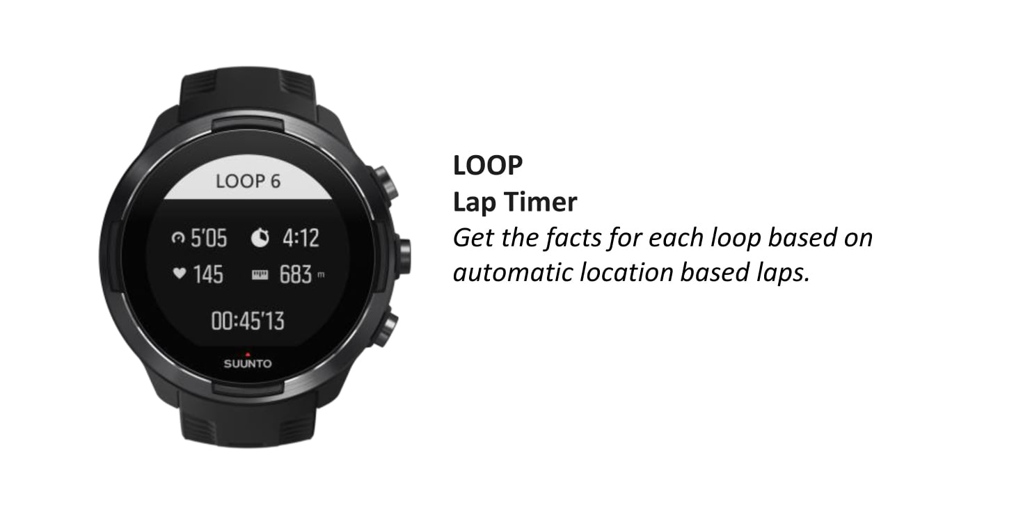
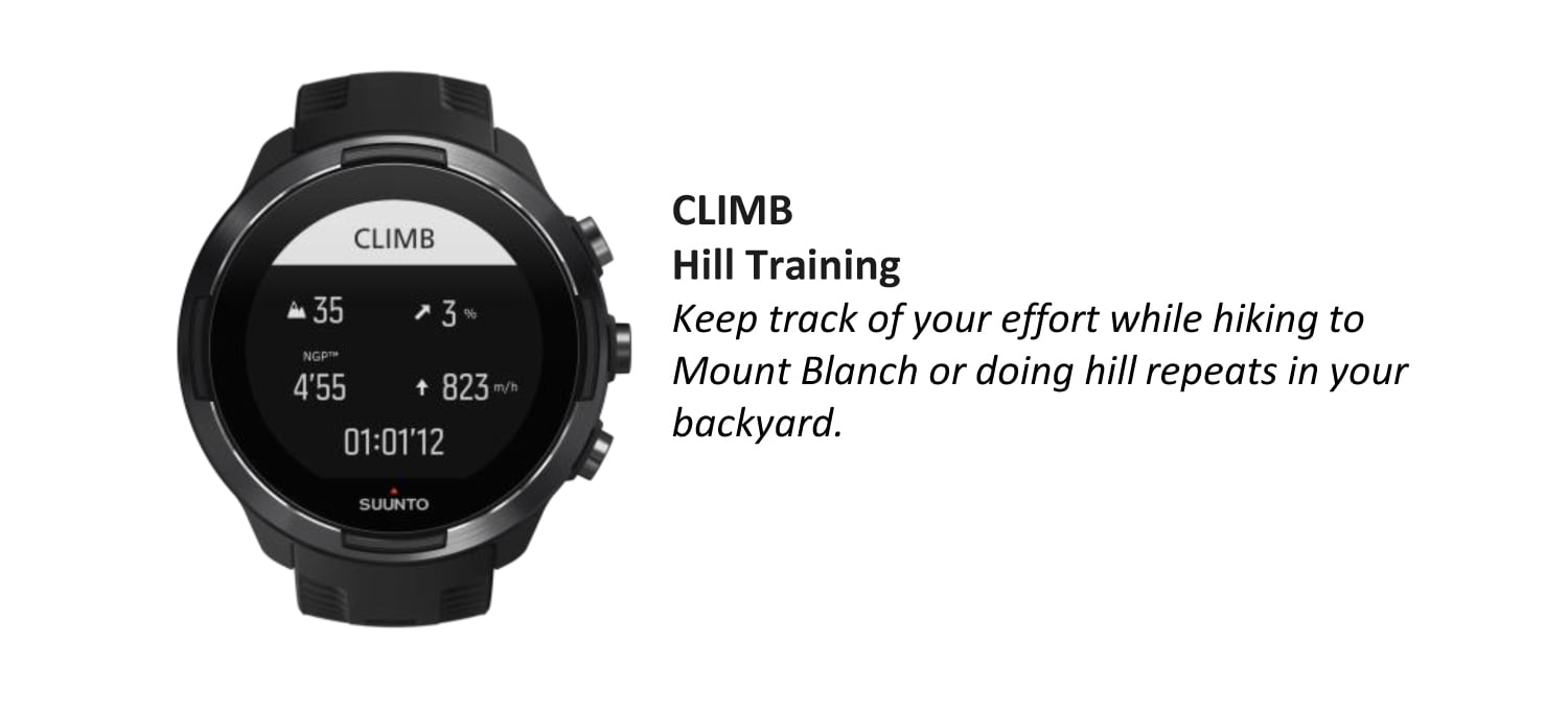
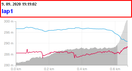
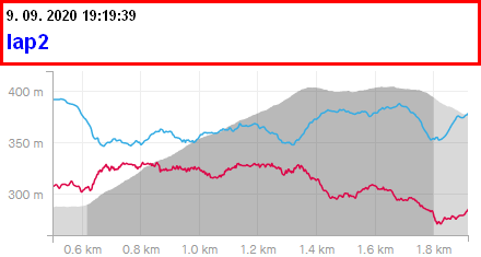
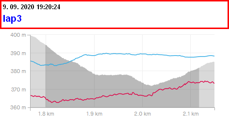
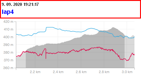
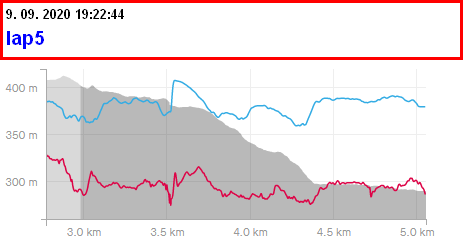
Ok, looks I am too stupid :). I tried suunto plus climb again and I do not understand those created laps by suunto plus climb, especially lap 3 and 5. Lap one is perfectly clear to me. Can someona explaine what I do not understand here? Altitude in grey
-
@inkognito Can one claim IP rights on the profits of a criminal enterprise? Do I have to
unpackacquire my own cheerleader outfit? -
@Fenr1r Oh, you’re right. So, it’s just the castle treasure then, I won’t get my $$$ from Suunto. And, to be perfectly clear, there will be NO giveaway from my precious cheerleader outfits collection.
And now back to serious Suunto business
-
@zvonejan give me a QS link
-
@zvonejan said in Software update 2.12.30 Staged Release for S3/S5/S9:
Ok, looks I am too stupid :). I tried suunto plus climb again and I do not understand those created laps by suunto plus climb, especially lap 3 and 5. Lap one is perfectly clear to me. Can someona explaine what I do not understand here? Altitude in grey


For second glance here.
Lap 1 the part before your climb and till where the climb starts
Lap 2 the climb till the climb ends
Lap 3 end of climb and the downhill / no climb part (could have been flat)
Lap 4 end of downhill / flat another climb
Lap 5 end of the climb and towards end
Remember laps, at just a sinlge “event” that marks and summarizes the previous time. For example think about and activity with one lap button press.You can two parts and the summary for lap 1 (or 0) and lap 2 (or 1). Hope it makes sense.
Here are some examples how it looks on Quantified Self
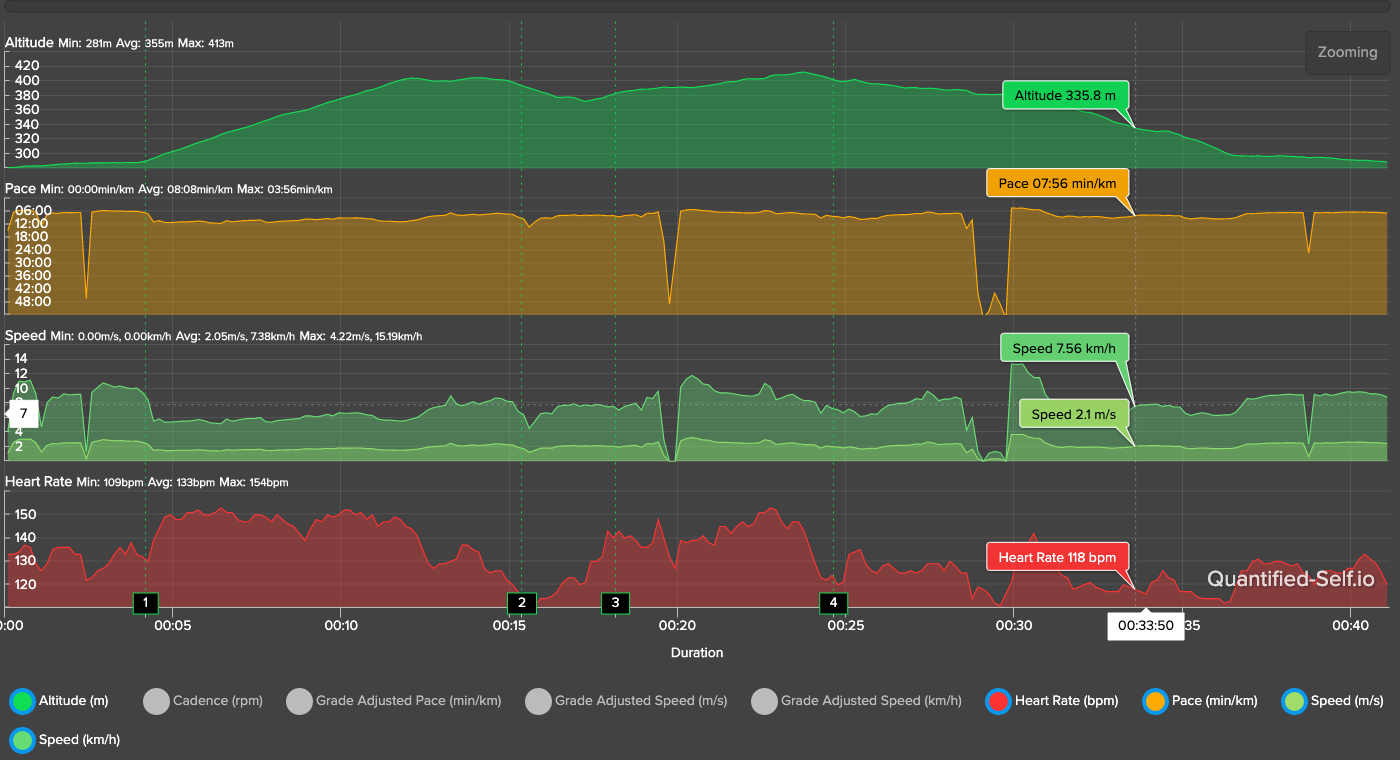
The green lines are the lap triggers creating portions of the activity as laps. (see below)

-
@Dimitrios-Kanellopoulos nice edition, very beautiful watch and wrist band!


-
@Dimitrios-Kanellopoulos I understand the lap 4 including a portion of downhill to confirm the climb is indeed over however the end of lap 3 wherein a portion of lap 4’s ascent is omitted seems to me the greater issue. That ascent seems to be part of the climb but as it is shoved into the descent lap it is not included. I understand that both confirming a climb is over and started are similar tasks but since the whole goal is to measure ascent performance real time it would seem important to be more strict on the starting demarcation, right? Maybe I’m oversimplifying this…

