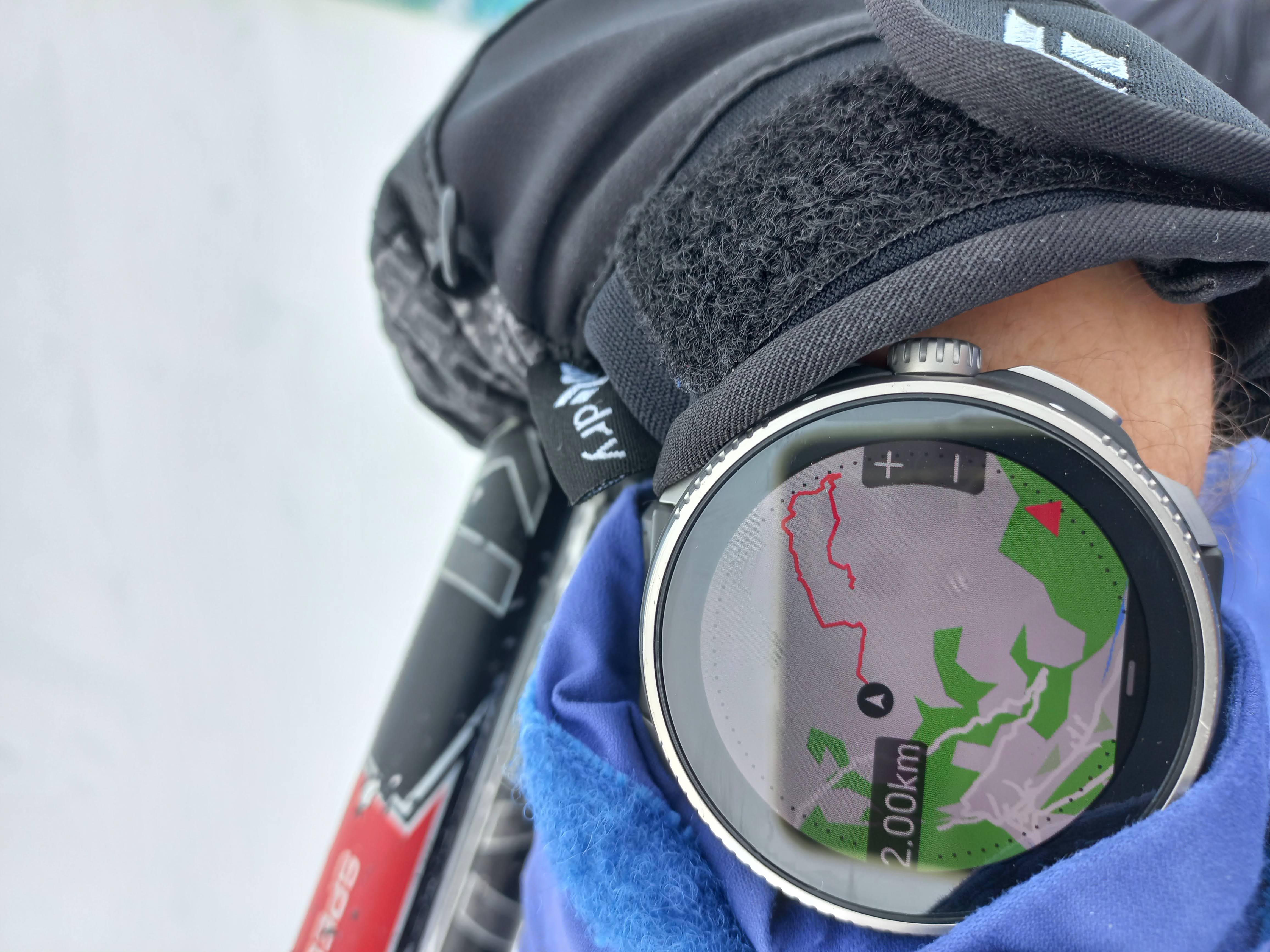
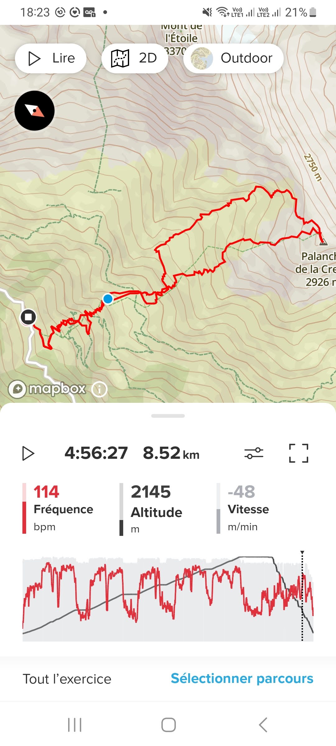
uncomplete track during activity
-
I am not happy with this issue either! I use this while ski touring extensively and depend on it. But, I cannot fix it and ranting won’t fix it. My solution now is to plot a route and load the route.
-
@Brad_Olwin
i always upload the route for all of my hiking activities but this route is only for reference and cannot fully rely on it.The actual route that i taken and the one i uploaded can be very different because there are landslide, fallen trees, fallen bamboo, overgrown vegetation etc blocking the path and i need to detour/avoid it by bushwhacking to open the new route. So when i going back to trailhead i need to refer back to my own breadcrumb (redline) instead of blueline.
-
@babychai I totally understand and am with you. Here is hoping the restoring of the feature lays groundwork for something new. I am hoping for elevation profiling but don’t know it that will happen.
-
@Brad_Olwin humor on
 lets have a closer look how many people get lost because suunto didnt fix this issue humor off
-
@GiPFELKiND said in uncomplete track during activity:
@Brad_Olwin humor on
 lets have a closer look how many people get lost because suunto didnt fix this issue humor off
I was faced with a junction in ski tour tracks, had to use my memory to pick the correct one…I was lucky:)
-
@Brad_Olwin
invite a split boarder in your group… don’t rely on luck
-
Ha, ha, ha, rumors say it‘s even possible to sleep and to leave your home without a gps watch on. But I‘m not sure about it.
The main function of a gps watch to me is to provide some extra comfort under good conditions and some extra margin of safety, when conditions are bad. I think we all agree on that.

-
@ortles
but bear in mind, an activity that has not been recorded is as if it has never happened
-
@freeheeler we welcome skiers on spatulas,
-
I tested the SR in alpine skiing, the watch is too sensitive for the count of descents which is greatly multiplied and the CO2 indication is wrong.
-
@fifi13013 the number and duration of runs is not perfect, it has been reported and I hope it’ll be improved in the future. I am not sure what are you referring at with CO2.
-
O ortles referenced this topic on
-
This is the oxygen value in the “weather” application, it tells me that 75% at 2300 meters. No problem for the altimeter compared to the city. I deactivated the map, it is of no use on the ski slopes,
-
@fifi13013
I am relatively confused now… -
You can find this info in the description of Weather - Insight SuuntoPlus app:
Oxygen level
“If you are above 2000 m (6 561 ft) you will get a reading on the oxygen % compared to sea level.”Suunto does not show the actual absolute percentage of oxygen in the air! That would be of no use for most people who do not remember the absolute value at sea level. The relative value that Suunto shows tells you how much oxygen is there compared to “normal” sea-level air…
To check the values, you can quickly calculate the relative percentage from any reference altitude to oxygen chart. I used this one: https://hypoxico.com/pages/altitude-to-oxygen-chart
It shows:
~ 20.9% of oxygen in the air at 0 m altitude (this is 100% by definition)
~ 16 % of oxygen in the air at 2134 m altitude (this is 76.6% of sea-level value)
~ 15.4 % of oxygen in the air at 2438 m altitude (this is 73.7% of sea-level value)Therefore I do not see anything wrong about 75% at 2300 m.
-
@inkognito Thanks a lot !
-
 S sartoric referenced this topic on
-
O ortles referenced this topic on
-
Im having the same problem with long treks or skitouring routes… any news on this? Thanks!
-
Hi! I often observed the same issue while cycling. It wasn’t a problem for me so far but doesn’t seem to be a problem specific to your watch. I also had it this week. So the issue seems to remain.
-
@soundso Thanks, lets wait then… it was a kind of major issue oince in white out and could not follow my red track back but the lue arrow which does not help cause the direction to the beginning part is something different than follow the route back (crevasses and so on…)
-
Yes, the issue still persists and has to be solved by an update of firmware.
Suunto knows this, the only thing we can do is keep the fingers crossed and hope that they prioritize the issue as well and provide a solution with the next update.

I have experienced the situation you have described by myself - whiteout on a glacier and you have to find your way back around hidden crevasses with no traces left. In such a situation a track back / non-disappearing breadcrumb track is really, really useful and may be the extra margin of safety you need there.
-
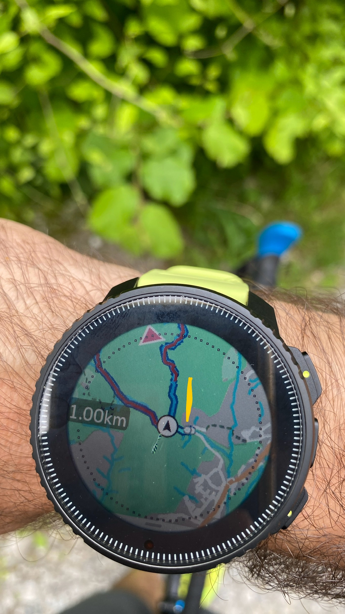
This is really annoying, it completely deleted the beginning of my route, the red part is missing from where I started… Ive put a yellow strip to let you see. It is literally ridicolus that you dont know where you started your route from… the blue is the tarck I was following but of course the beginning i did not follow the blue trackj but my own and on the way back I could not follow it back


