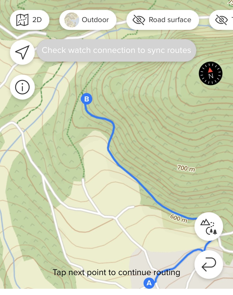
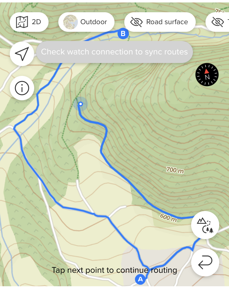
SA: route planner
-
@Likarnik it is not the only reason, there are trails that are marked as private property, trails that are marked only for some activities, etc.
-
@gi0vanni said in SA: route planner:
missing info in the map or what? (btw, that piece of forbidden path does not present any difficulty, nor it’s private)
As I already said, find it in the openstreemap editor and check. Openstreetmap is a community effort, so there are errors that users can fix.
Edit: I can also check that for you if you share the position of that trail
-
@isazi it’s marked highway=path so should not be a problem (used by pedestrians, small vehicles like bicycles, and/or animals. This includes walking and hiking trails, bike paths, horse and stock trails, mountain bike trails, as well as multi-use paths for cyclists and pedestrians or similar combinations)
-
@gi0vanni Where is this path? Tell us, so we can check it.
I changed some feutures in OSM because it was wrong mapped and not routable in SA.
-
@gi0vanni
highway=pathmay not be enough, depending on other metadata of the track -
@Mitch9 said in SA: route planner:
Where is this path?
-
-
I guess the problem is very probably the river crossing

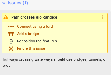
-
@Mitch9 said in SA: route planner:
@gi0vanni I think the problem is this:
sac_scale: unknown
So the SA planner always avoids paths where key sac_scale is unknown?
-
different, but related to SA planner. It makes me crazy planning route for road biking, where it:
- does not follow straight road and use non logical shortcuts
- prioritize cycling paths (even sidewalks) over the road
so in order to use tbt I have to manually adding planning points to avoid using of shortcuts, what is really pita.
-
@dombo said in SA: route planner:
It makes me crazy planning route for road biking, where it:
- does not follow straight road and use non logical shortcuts
- prioritize cycling paths (even sidewalks) over the road
so in order to use tbt I have to manually adding planning points to avoid using of shortcuts, what is really pita.
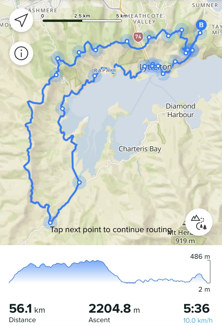
Yeah, I agree that it’s a PITA although I think I have just gotten used to it now. Often I’ll have to plot 3 or 4 smaller points/segments along what is essentially a straight road because the SA map sends me off all over the place it I try to go from a simple A to B point. Sometimes I can get around this a little bit by changing the road surface, for example setting it to paved roads for road cycling but a lot of the time it’s like it wants to pick the craziest routing to get to where I want to get to; I’ll often have to change this a few times if I am mapping out a larger route. Instead of having a small number of points plotted I end up having to drop in lots just so I can map the actual route I would like to travel. Here’s one as an example, case in point

-
There are some unroutable segments out there and this has nothing to do with difficulty or danger. Some places in OpenStreet Map just can’t get routed through. There is a bike/pedestrian bridge over a highway where i live (and ride) and you just can’t do a route through it. I tried to check the OpenStreet map and edit it, but that segment has the correct attributes. Btw. it does not work for creating routes in SA, but also in Strava.
-
plotaroute.com is also based on OSM maps and routes anything without issues. Same for the Footpath app. Can someone explain, why there are differences in routing? For me it seems, that SA fails and the others can manage route creation in a better way. But I cannot explain it to me why this is the case.

-
@trailcafe Indeed! yesterday i took some time to plan well known routes with SA and twice i ran into the same problem. komoot however worked without any problems. it is a pity for SA, just hope they will address this issue in the future
-
@trailcafe
OSM is the source of data : points, path, tracks, etc… are created there, with attributes.
Then, there are map generations using these source of data, and each map generator (OSM itself for itself, or mapbox for others, or openandromap, etc…) are taking attributes and filter, tweak, to display the way they want/can.
Then it comes to routing, where same OSM data source is used by routing engines to follow what can be followed using routing profiles (sometimes one can see routed path on a “path” not displayed on the map itself )
)Something in OSM not routable “at all”, and no routing engine will go through this.
But something routable, according to some profile criteria can be walked through but not cycle, etc…, and finally (maybe not complete explanation, just my own understanding) which optimisation or path choosing when multiple are possible, it is the magic inside each routing profiles/engines i think.Then SA/Komoot/etc use all OSM raw data, have potentially their own mapping “provider”/“sources”, and also their “own” routing engine/profiles.
It may just explain the differences, not why SA is not the best at routing (according to users).
-
@Mff73 thank you very much. When I get it right, SA could improve its mapping because it’s using “its own” routing engine that could be tweaked to e.g. route all visible paths (or any other criteria).
-
@trailcafe not sure Suunto App is using its own routing, I believe they use the mapbox API.
-
I just went into OSM and checked the metadata of some paths:
- and 2. picture is correctly routed by SA, 3. picture shows the path that SA ignores. I can’t see any differences in classification
Link to area: https://www.openstreetmap.org/edit?editor=id#map=17/47.57343/11.21559
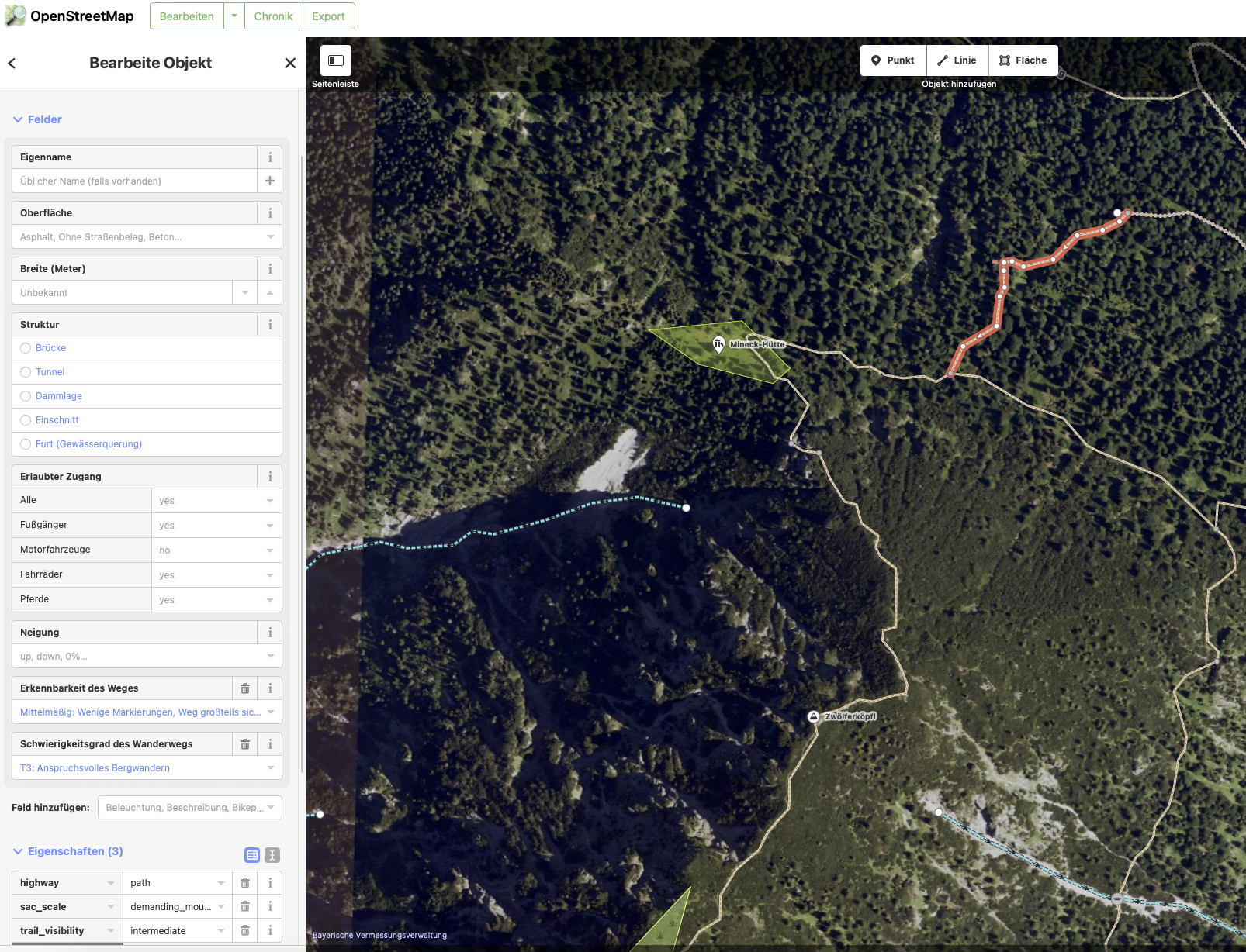
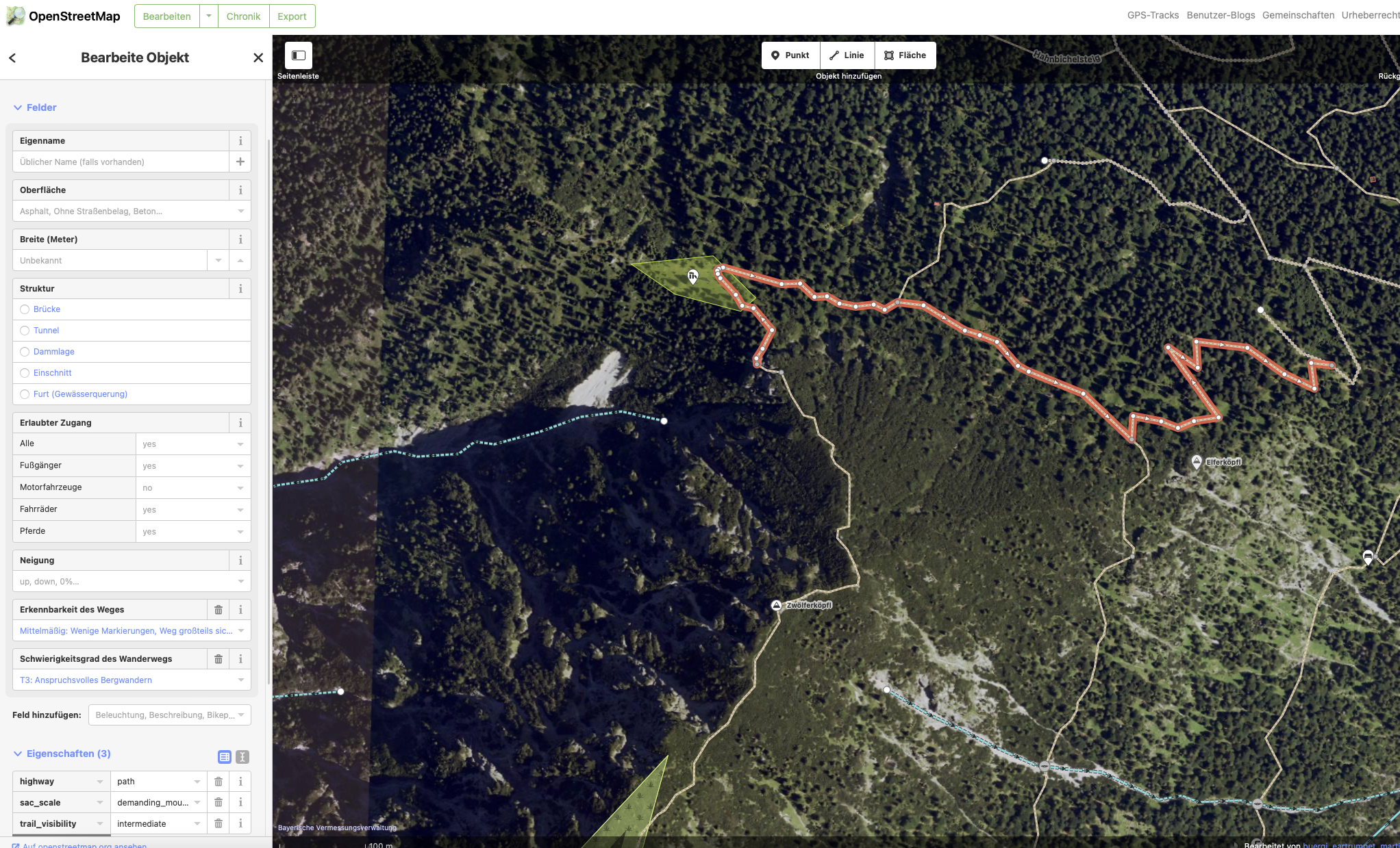
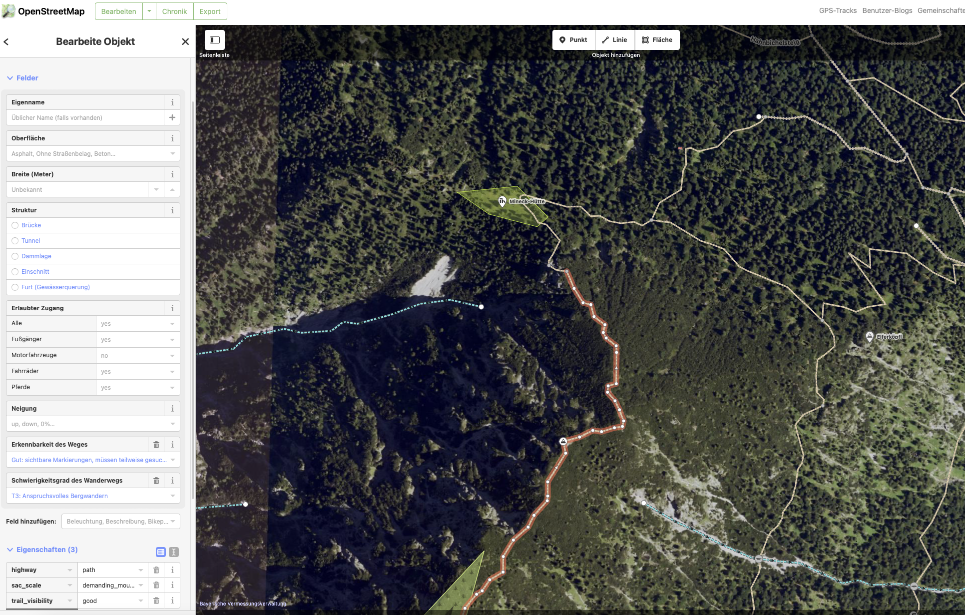
The Mapbox API does not have any high sophisticated settings
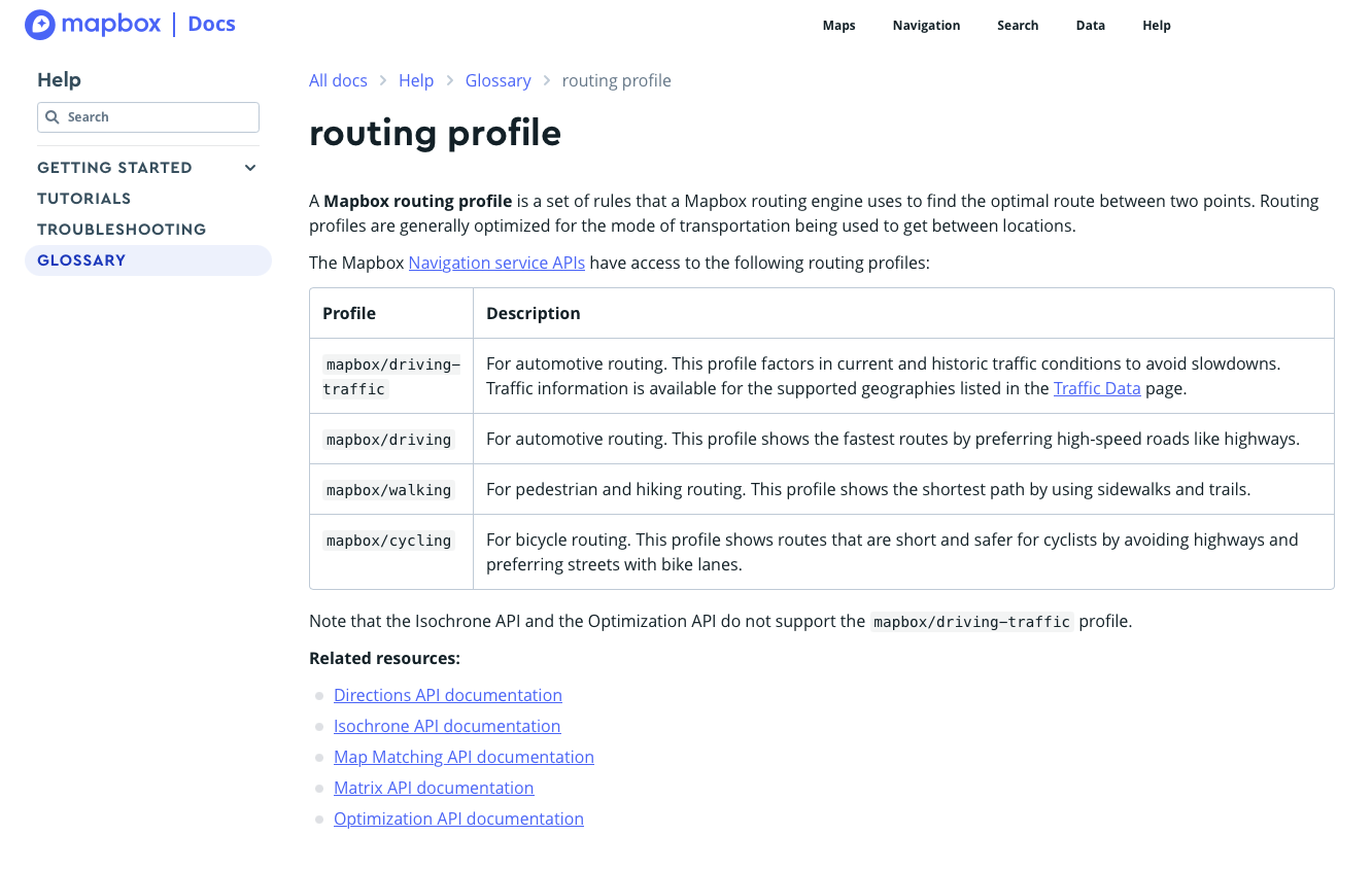
https://docs.mapbox.com/api/navigation/directions/ - and 2. picture is correctly routed by SA, 3. picture shows the path that SA ignores. I can’t see any differences in classification
-
@trailcafe
Sometimes it is not the path itself which is faulty, but its non proper connexion with other paths. Just one point not linked and the path, properly setup, is a dead-end, and routing will avoid it. -
@Mff73 Yes, and that is also understandable. But that does not apply here in this example.
