Avalanche terrain map on the watch
-
@freeheeler it depends on what you are using the information for. It’s intersting to know the total amount of snow if you want to know if it will be a deep day or not
 But you don’t get the whole picture. We often take short cuts and thats something that is left from our time in the caves. So this kind of information could be such a shortcut that could lead to bad decisions.
In Norway we have som mountain rules and one of them is “It is not a shame to turn and go back”. So don’t be a sheep and follow the others without thinking
")
In May i was on a backcountry tour and just under the summit we did the lunch break. I don’t remember which level we had but it was more than reported. Right before the lunch break theres was an avalanche. To this point we went up all the way <30 degrees
-
Indeed, having the avalanche map available on the watch wouldn’t make it the only tool to use.
We already have to juggle with multiple apps (mobile or desktop) with different capabilities (online only or offline capable, 2D or 3D), for different uses (planing a trip, sharing plans, tracking) and map layers (by country, slope angle, recent avalanches, avalanche terrain, terrain hazard, dynamically taking latest avalanche report and risk reduction method into account…).
-
The 2025 Q2 Vertical firmware release notes says
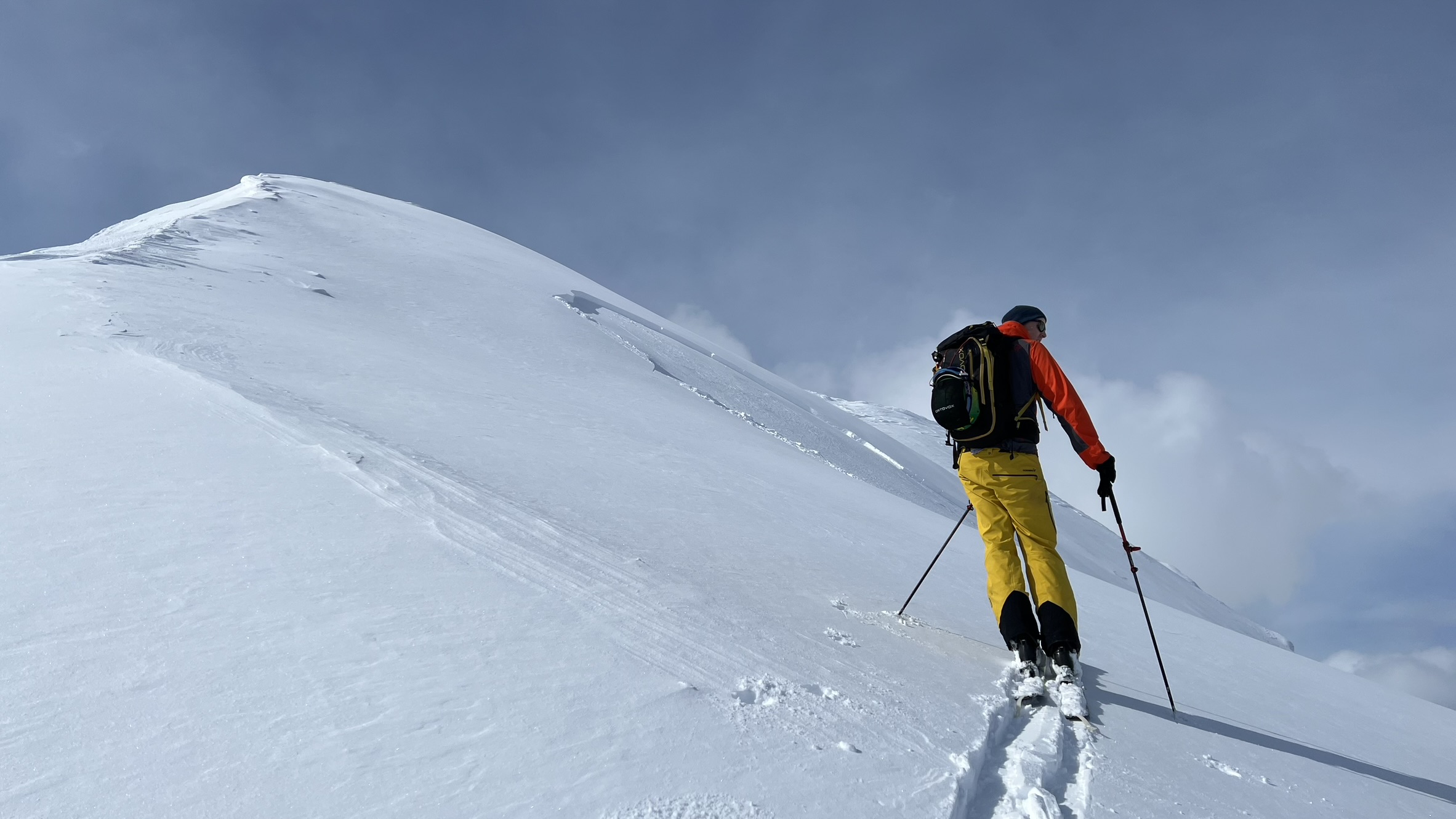
New winter map stylesDoes this new map style include the slope? Could someone enjoying the mountains send us a picture in action?
-
@tuxella Someone from the southern hemisphaere maybe? Its a winter map after all
-
@tuxella no, it is just different rendering of the same data
Watch: Suunto Vertical 2 Titanium Black
Blog: isazi's home
-
@isazi Thank you, this is what I guessed when I realised it didn’t require to re-download maps.
Let’s hope this will come one day
")
-
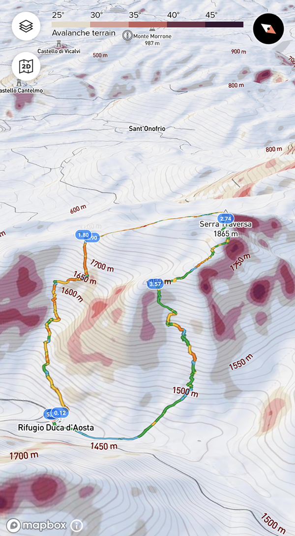
The past Sunday I had a short snowshoes hike and realized that it’s really a pity that the avalanche map isn’t available directly on the watch. Notwithstanding all the above discussed limitations, it gives a zero-level information on the potentially dangerous areas and it would be helpful especially if you are forced to change your planned itinerary.
-
I don’t think it’s worth looking at avalanche terrain at this point, on the small watch. Plan ahead and mark tricky spots with waypoints.
-
In Norway we have a dedicated app with avalanche informasjon and a slope map on the web. It would be nice to see the same colors on suuntos avalanche map:
Instagram: https://www.instagram.com/helgelandsbukken/
https://www.instagram.com/suunto_adventures/
IG: Helgelandsbukken, suunto_adventures
Vimeo: vimeo.com/helgelandsbukken
Blogg: https://turblogg.midnattsola.com -
@Stefan-Kersting I just discovered Norway uses slightly different colours from the ones used in national cartographic institutes in France and Switzerland:
France

Switzerland

Norway

Skitourenguru

Suunto

I guess users from every country can’t be happy at once. But at least Suunto could refrain from adding another color range.
-
unfortunately theres no international standard for these colors
Hello! It looks like you're interested in this conversation, but you don't have an account yet.
Getting fed up of having to scroll through the same posts each visit? When you register for an account, you'll always come back to exactly where you were before, and choose to be notified of new replies (either via email, or push notification). You'll also be able to save bookmarks and upvote posts to show your appreciation to other community members.
With your input, this post could be even better 💗
Register Login