Elevation data and measurement
-
So, I went to a trail run yesterday, I planned route in SA and in kamoot separately.
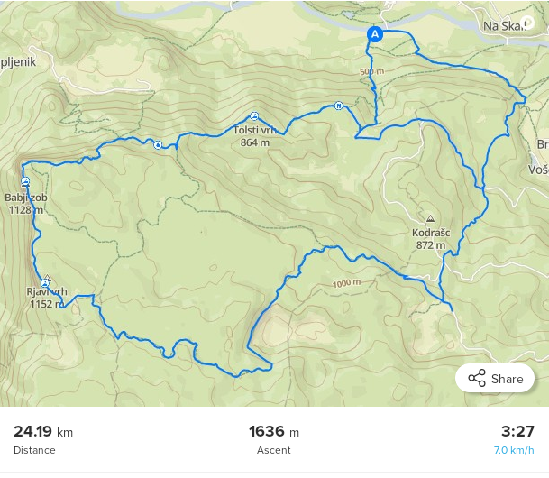
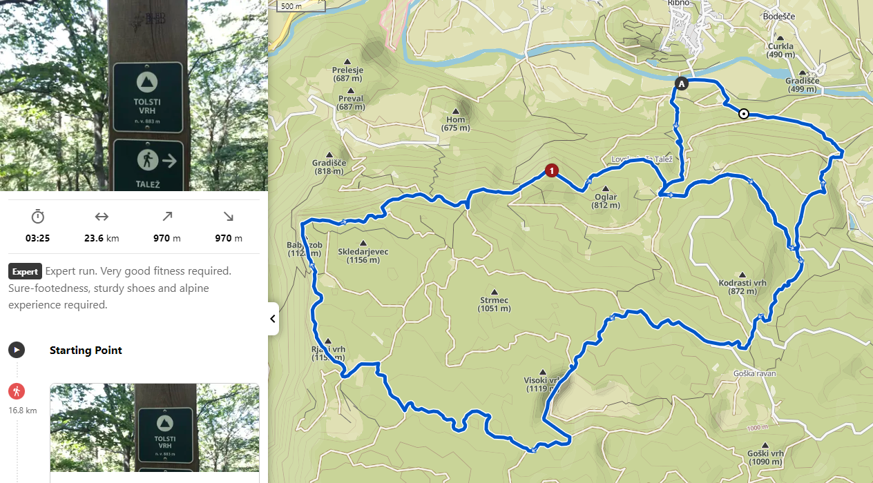
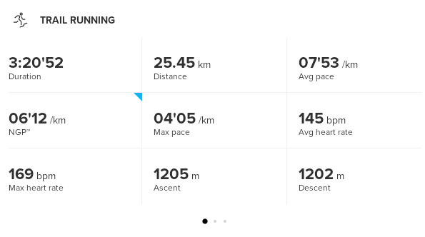
SA shows 1636m of ascent, kamoot shows 970m of ascent. But when I did a run, S9PP showed 1205m of ascent
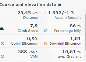
after the exercise synced to Runalyze, Runalyze showed 1352m of ascent (I know that Runalyze “fixes” elevation)
But, why do we have such differences between services and devices? I can only guess that watch is correct, but that can only be true if Barometer/GPS/fused alti were correct.
My biggest problem is SA showing almost 50% more ascent, that can be misleading -
@Dušan-Ković SA always overestimates ascent for me, useless for planning hilly routes. Komoot is more on point and even if it is not 100% it at least estimates duration quite good for me (I’m always a little faster than athletic), so that is enough.
-
@Likarnik I know, but it would be nice not to overestimate, at least to be close enough

-
@Dušan-Ković said in Elevation data and measurement:
@Likarnik I know, but it would be nice not to overestimate, at least to be close enough
Many time discussed : basically the elevation estimation mainly depend on the map raster used and its resolution, combined with the program that uses it (komoot, SA…)
For instance in France when I want a good estimation of elevation I will use the “ign” rasters that are the best to me. But there are always differences whith final mesurement.Your S9PP is more precise for elevation mesurement than most public rasters.
Hello! It looks like you're interested in this conversation, but you don't have an account yet.
Getting fed up of having to scroll through the same posts each visit? When you register for an account, you'll always come back to exactly where you were before, and choose to be notified of new replies (either via email, or push notification). You'll also be able to save bookmarks and upvote posts to show your appreciation to other community members.
With your input, this post could be even better 💗
Register Login