Movescount & altitude profile
-
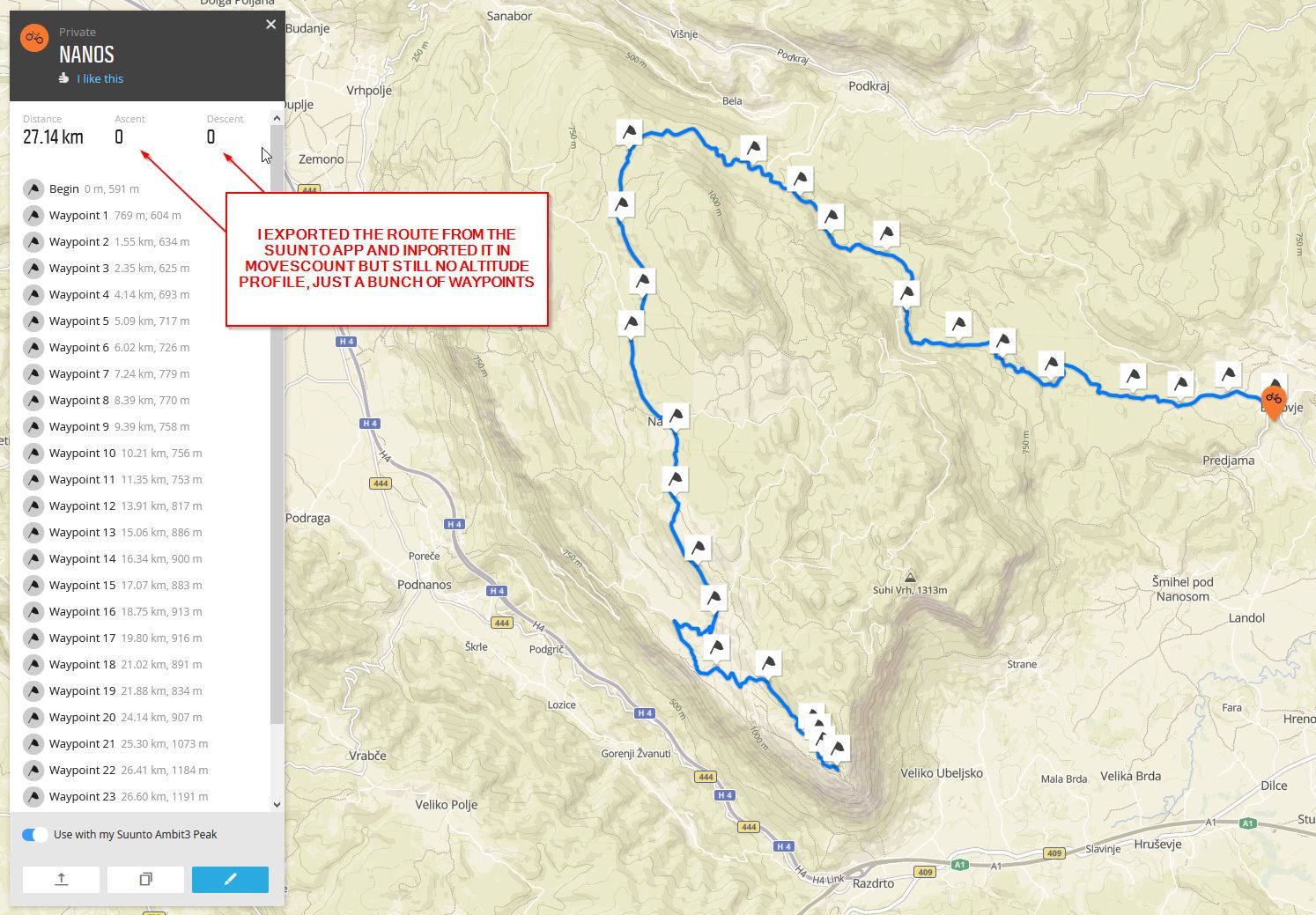
Why movescount do not show altitude profile? I created a route and movescount show 0m ascent when it should be at least 700m.
-
Hi, which watch are you using?
-
Ambit3 Peak
-
OK, I see. That by the way looks like a very nice climb with your bike!
When you take a look at the log on your watch, does it show the climb and altitude change? If so, I would guess it is Movescount that creates the issue, but have no recent experience with Movescount since I use the Suunto app and QS, sorry. Let’s see what others post here. Have you tried to upload to QS (Quantified Self.io)? QS gives you great analytics and maybe solves your problem?
-
@mitkos That Movescount web interface is on its way out. It hasn’t provided elevation measurement for quite a while. I doubt it will again before The End.
-
That’s quite old issue by now. Many months have passed since route altitude has been gone. No public statement by Suunto at any moment about the existence of the problem, let alone if and when they plan to fix it. But since they are only removing features of movescount lately and stripping ambit3 of it’s features, I wouldn’t really put much hope to this being fixed ever. Ambit3 is de facto discontinued, although that’s not stated officially. That much is obvious.
-
Is there a workaround? I contacted Suunto and they gave me this suggestion:
“Yes, there is currently some issue wit the Altitude data for route planning. At this moment, you can use the Suunto app to plan the route first in order to see the correct altitude data. If it is as your plan, then you can export it to the Movescount website and sync the route to your watch via Suuntolink.”
I tried but still no succes…


-
@mitkos said in Movescount & altitude profile:
“Yes, there is currently some issue wit the Altitude data for route planning. At this moment, you can use the Suunto app to plan the route first in order to see the correct altitude data. If it is as your plan, then you can export it to the Movescount website and sync the route to your watch via Suuntolink.”
They missed the part where they were supposed to tell you that when you do it this way, you will still not see the altitude profile in movescount, but the altitude data will be transfered to your watch. So you will see the altitude profile in the watch.
It’s really funny how they recommend using suunto app for creating a route and to export it to movescount. Why wouldn’t they just enable direct sync of routes to A3P or to movescount at least?! This is so awkward. It almost feels like Suunto app is some third party app and not in house solution. They are just making things more and more complicated.
-
-
I really liked route planning in Movescount, and would be happy if this functionality would remain and could send the routes to the Suunto app. It support waypoints, and it’s free. I know there are 3rd party route planning sites, but waypoint support is either missing or premium feature.
-
@halajos said in Movescount & altitude profile:
waypoint support is either missing or premium feature
Waypoint support should be pretty common. But Suunto’s idea of waypoints is kind of… special. So waypoints / POIs from most sources are just ignored by both Movescount and Suunto App.
But there’s www.plotaroute.com - it lets you create routes with waypoints even without registering and those waypoints actually show up in Suunto App & Movescount. Though only with generic icons.
-
@margusl plotaroute allows to create up to 5 waypoints for free, AFAIR
-
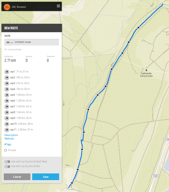
@halajos , random sample imported to Movescount once it was created in Plotaroute without signing in first (I do have a plotaroute premium) :

They make no secret of what comes with Premium - https://www.plotaroute.com/subscribe
“Plot with Waypoints - 5” is not a limit of supported waypoints, it’s a limit for a “Plot with Waypoints” tool - you place a set of draggable waypoints on a map and Plotaroute does the routing for you. -
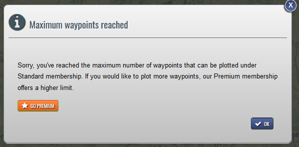
@margusl after the 5th waypoint I get this

-
@halajos , quoting myslef:
“Plot with Waypoints - 5” is not a limit of supported waypoints, it’s a limit for a “Plot with Waypoints” tool - you place a set of draggable waypoints on a map and Plotaroute does the routing for you.
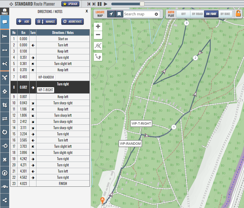
Don’t use that [Plot with Waypoints], instead add your waypoints later to existing route like everyone else [:
, either by adding a label to existing direction or adding a new direction with a label:

Besides, “Plot with Waypoints” tool uses draggable waypoints only for route creation. Once you are finished with that tool and click “Make into route”, those points are gone and you would still need to add your points manually as labeled directions.
-
@Prenj said in Movescount & altitude profile:
This is so awkward. It almost feels like Suunto app is some third party app and not in house solution. They are just making things more and more complicated.
As it probably was bought from a third party and reskinned. I don’t see any other technical answer to all those decisions.