FusedTrack or GNSS bugs
-
Introduction
This post is not related to general GNSS accuracy in S5 but might be related to how FusedTrack or latest GNSS firmware works in areas of poor GNSS reception - it seems that FusedTrack is able to draw absurdly complicated and long tracks with impossible to reach speeds (tempo) where it should simply connect two points with straight line (two last known locations) if there’s not enough data available.I’m aware of GNSS limitations (in general and in wearable devices) and I’m also aware that I had performed a workout in difficult signal reception conditions (overcast, valleys and hills, dense forest, large rock formations, generally considered bad), hence this post is not about S5 performing poorly in such conditions.
I hope that this post will help in debugging such issues and will lead to a better software.
Workout links
- To Pravčická brána: Where problems occured (GPS + Galileo) - https://www.suunto.com/pl-pl/move/ukaszszmigiel/5e512fdcc3cd600ac20a0276
- From Pravčická brána: No problems (GPS + GLONASS) - https://www.suunto.com/pl-pl/move/ukaszszmigiel/5e512ff440d0e467adf4d0a7
Workouts recorded on Suunto 5 with firmware v2.10.26.
First problem
Navigation went mad around 7.5 km into the workout, loosing GNSS signal for a while, recovering for a moment and finally drawing a long and curved path with absurdly large error which seems to be related to FusedTrack algorithm.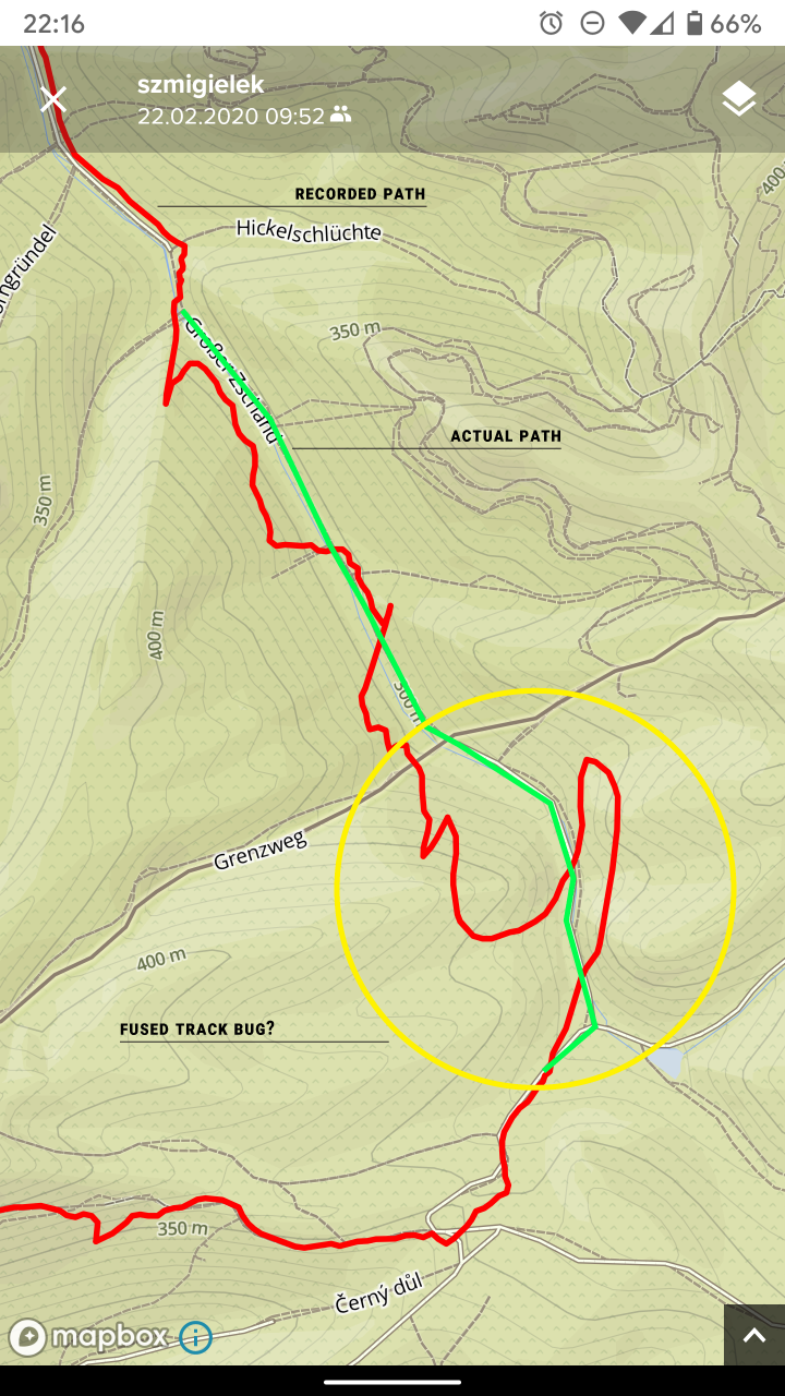
Above: Error overview
Above: Error closeup with tempo reading.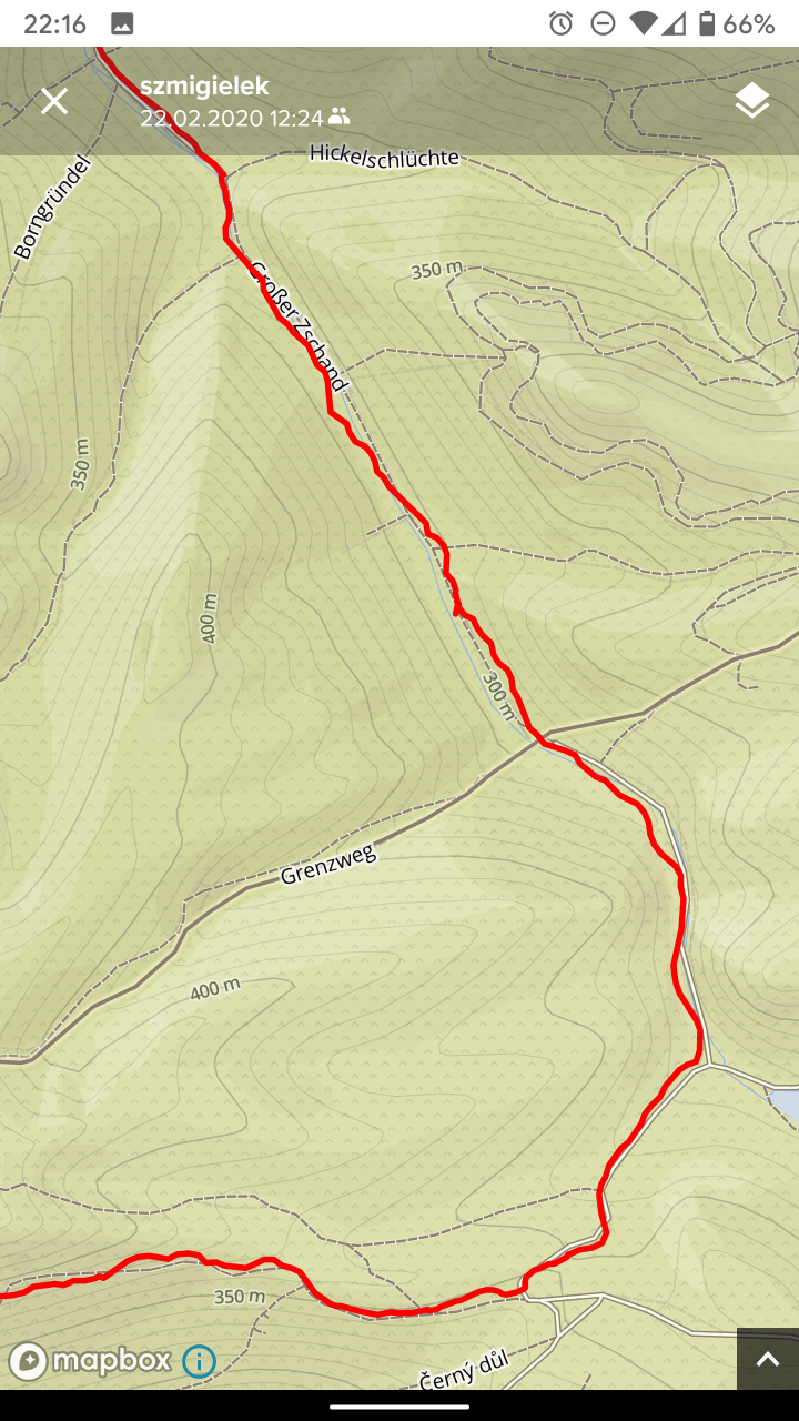
Above: Same area with GPS + GLONASS on way back for comparison.Second problem
After navigating final few kilometers and reaching Pravčická brána and climbing to an elevated vantage point with a clear sky view, S5 lost GNSS signal and didn’t recover - I had to save the workout, change navigation settings to GPS + GLONASS and start new workout on my way back.Perhaps it is related to the way S5 caches satellites visibility as during the time prior to loosing navigation I was exploring the rocky area which meant that in short period of time different parts of the sky were switching from being obscured to visible and I was doing plenty of mixed running and stationary sightseeing (auto-pause was off but I paused the workout manually at last twice). But still it is super weird as it finally died when I had clear sky in all directions.
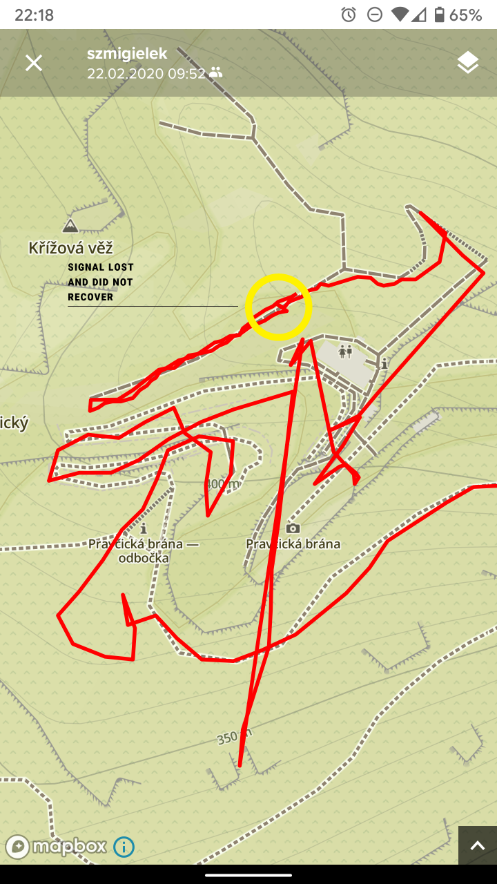
Above: Signal lost in area marked in yellow (elevated vantate point with a clear sky view) - it didn’t recover for a few more minutes, regardless of being stationary or moving.Extra
I’ve lost signal when traveling back (GPS + GLONASS) but this time the behavior was expected - the watch connected two points with known location with a straight line instead of drawing an absurd shape.However, on the same image (below), take note of the area in the lower center part of the screenshot (around Lovecka trubka). Looking at the map you can judge that in this place a different part of the sky is being obscured by the rocks and immediately a different part is being visible (path direction changes from east-west to north-south. This time also watch continued to draw a path in eastern direction - perhaps because I was still moving but the signal was lost momentarily so last known direction was being extrapolated instead. However - the error is nowhere as bad as in the first example and when the signal was recovered, the track continues in the similar shape as the actual path on the map (the offset is there but it gets corrected over time and this is to be expected with FusedTrack).
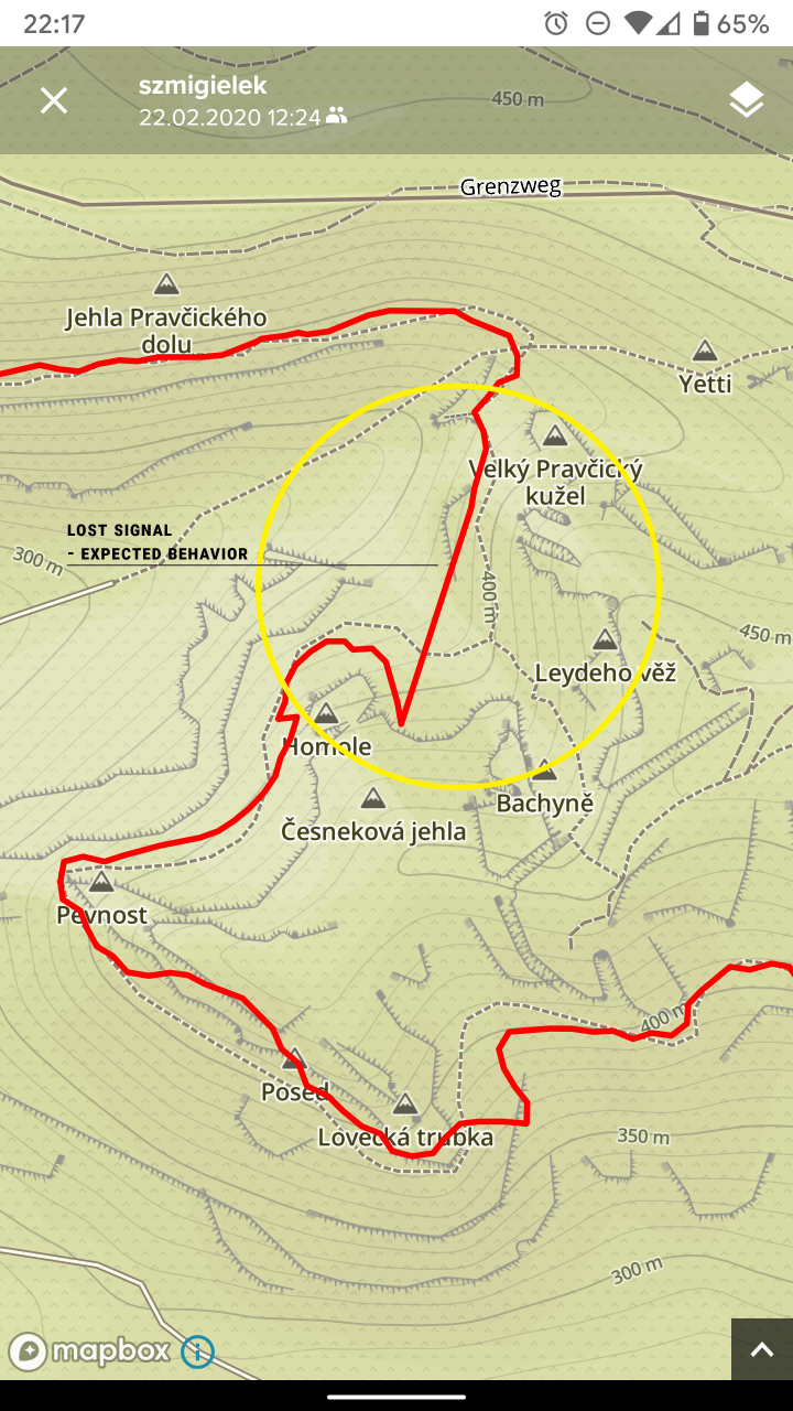
Above: Expected behavior in case of poor GNSS reception marked in yellow and interesting behavior in lower center area (Lovecka trubka). -
@Łukasz-Szmigiel
For issue n°1, did you check if the compass went nuts ?It happened to me once … I was on path but the recorded track was off, like I was heading in the wrong direction
Obviously , I had to go back (nice steep slope
 ) to look for the correct path… that I was already following
  and compass fixed itself
Some time wasted, some bad words shooted and then, restart the ascent
-
@sartoric there’s no compass in S5. Also I was travelling via a path through the valley, pretty straight - check the green line I’ve overlaid on SA screenshoots.
-
@Łukasz-Szmigiel
Oh … you have an S5, I thought you have as S9 … so you shouldn’t have fusedtrack.anyway, mine was pretty straight too


-
@sartoric lol I was quite sure there’s FusedTrack on S5 too. Anyway - the weird path that I got is even more bizzare now

I’d expect a simple - no GNSS signal, pause and wait or continue - but I got a bezier curve instead

-
@Łukasz-Szmigiel
Maybe you just got bad signals -
@sartoric https://www.suunto.com/en-gb/Support/Product-support/suunto_5/suunto_5/features/fusedspeed/ - this must be the reason why I thought S5 also has FusedTrack.
-
@Łukasz-Szmigiel
Yep. FuseSpeed is a reaaaaally old feature
-
Reported this. There is already a new GPS FW coming up FYI
-
@Dimitrios-Kanellopoulos thanks, I appreciate it.
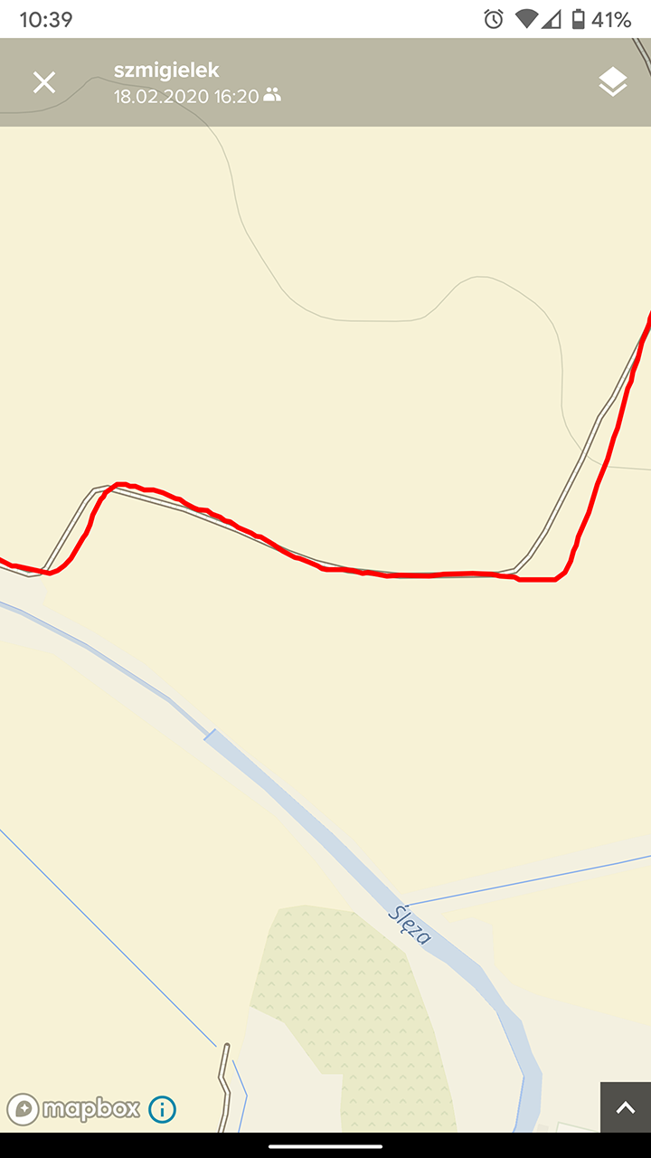
Btw. I’ve noticed that when using GPS + Galileo there are times when strange offset occurs and I’ve observed it with multiple workouts. With GPS + GLONASS path seems to drift due to typical GNSS error between readings and it looks pretty normal (the error is different every second and recorded path looks like a zigzag). But with Galileo this offset sometimes applies for quite some time ie. a km or more and it seems as if it was applied on one axis only. This may be related to issues described in this thread. Example below:
Above: GPS + Galileo offset.