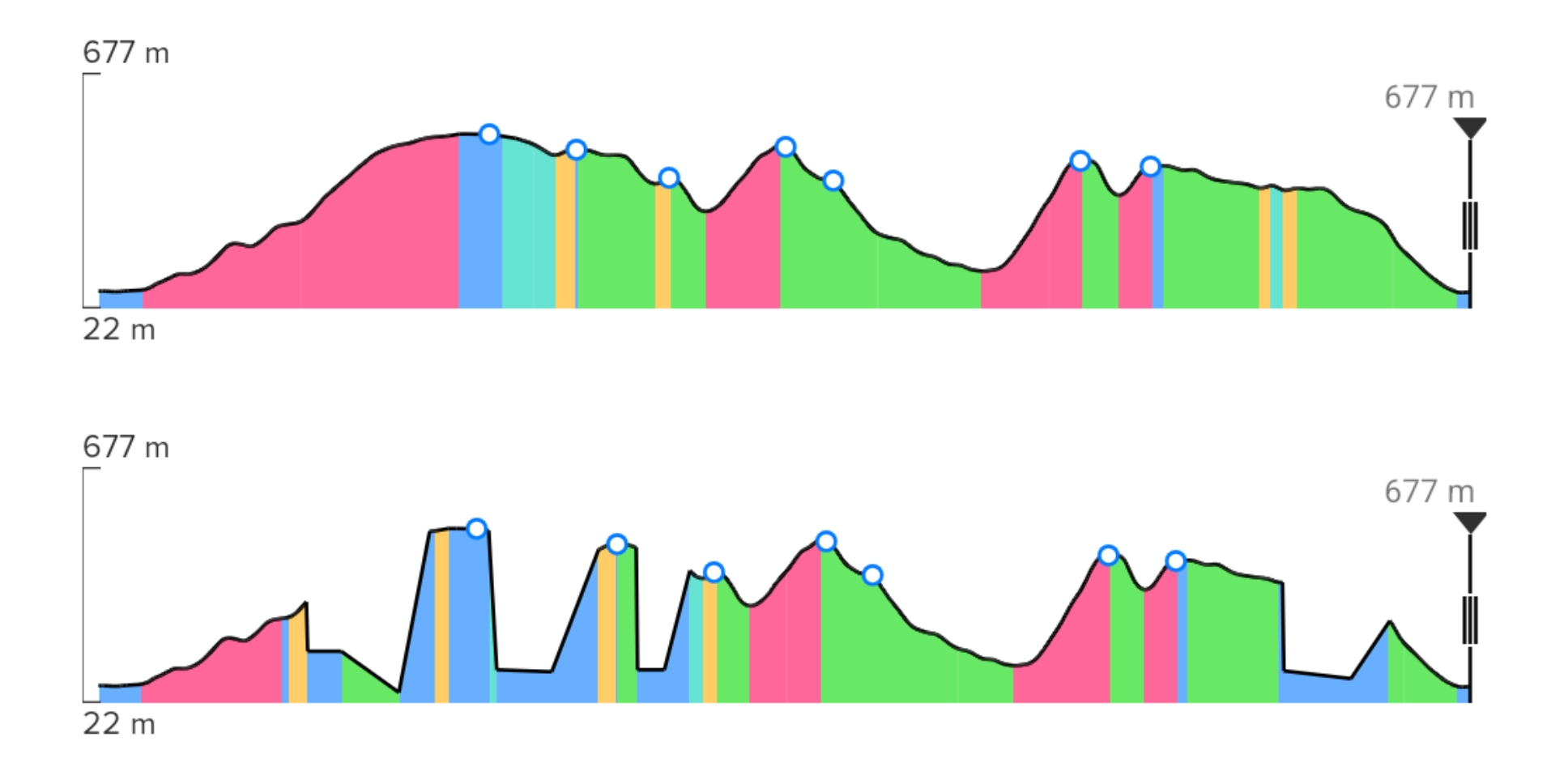
Elevation profile of routes created in Suunto App
-
Hi again,
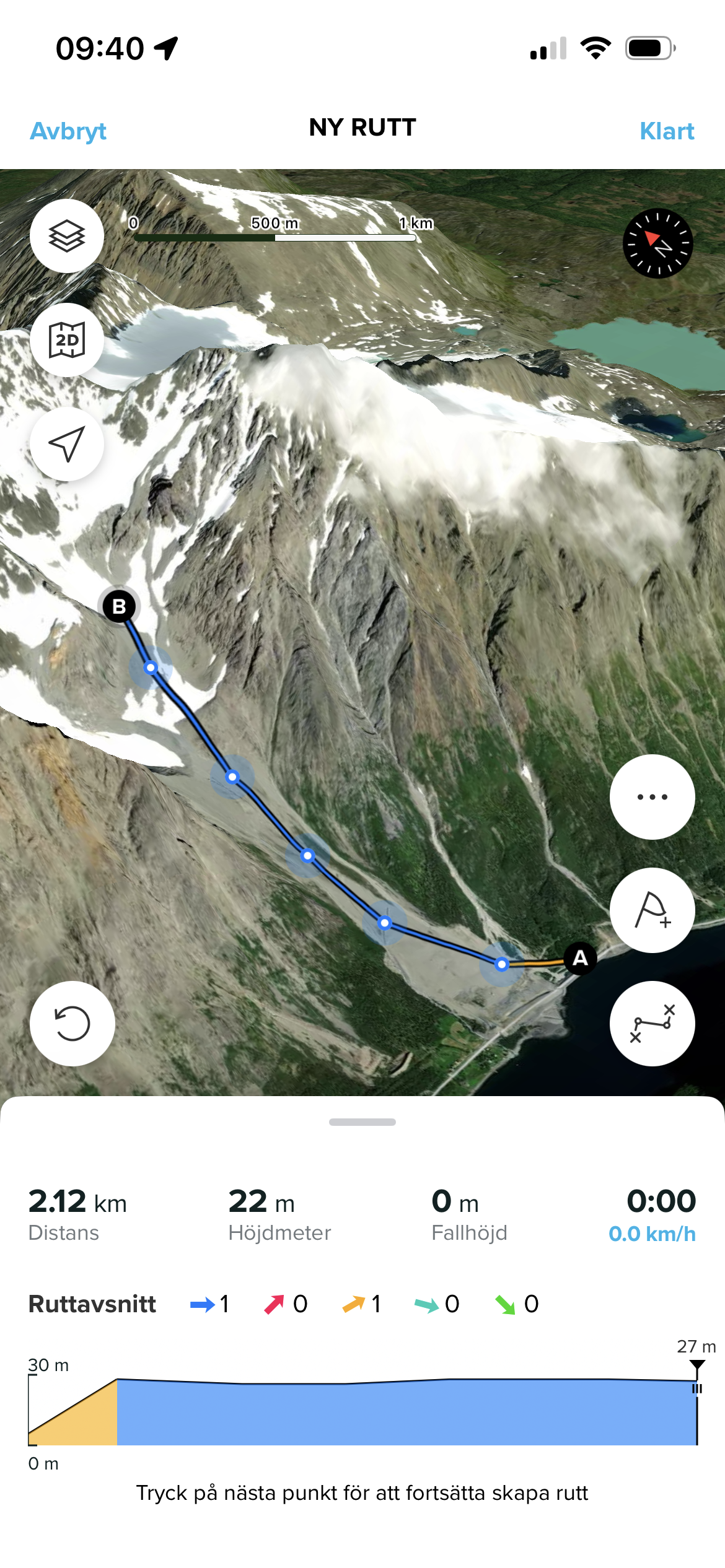
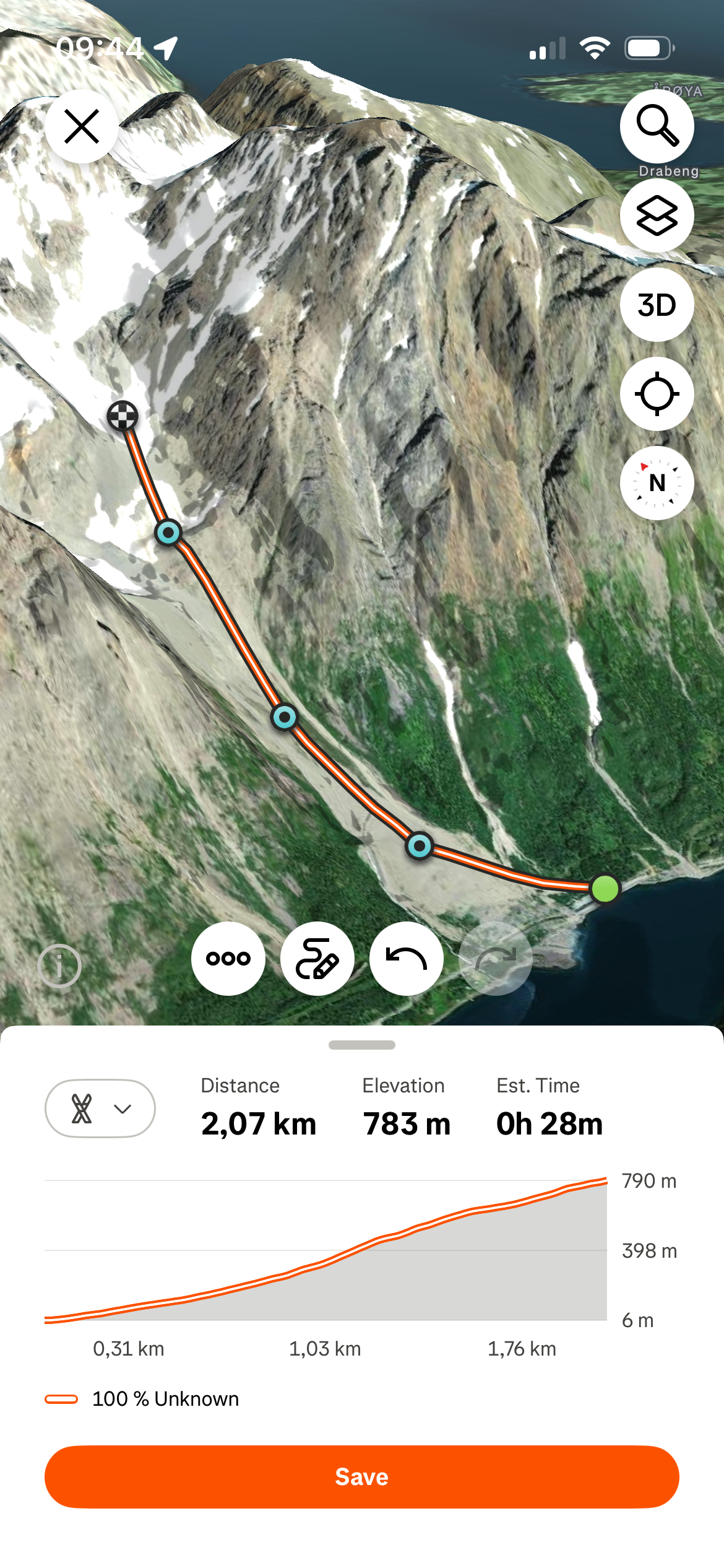
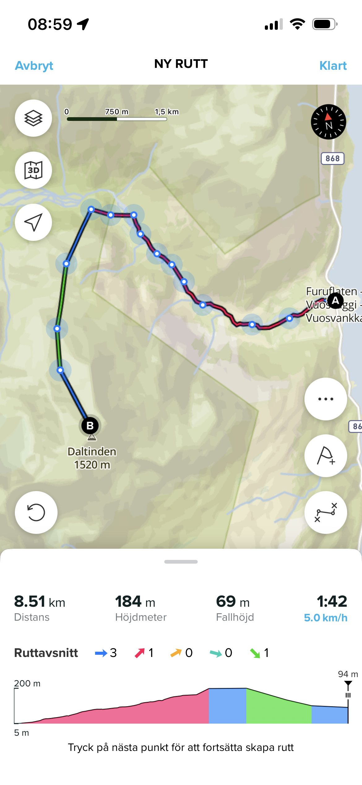
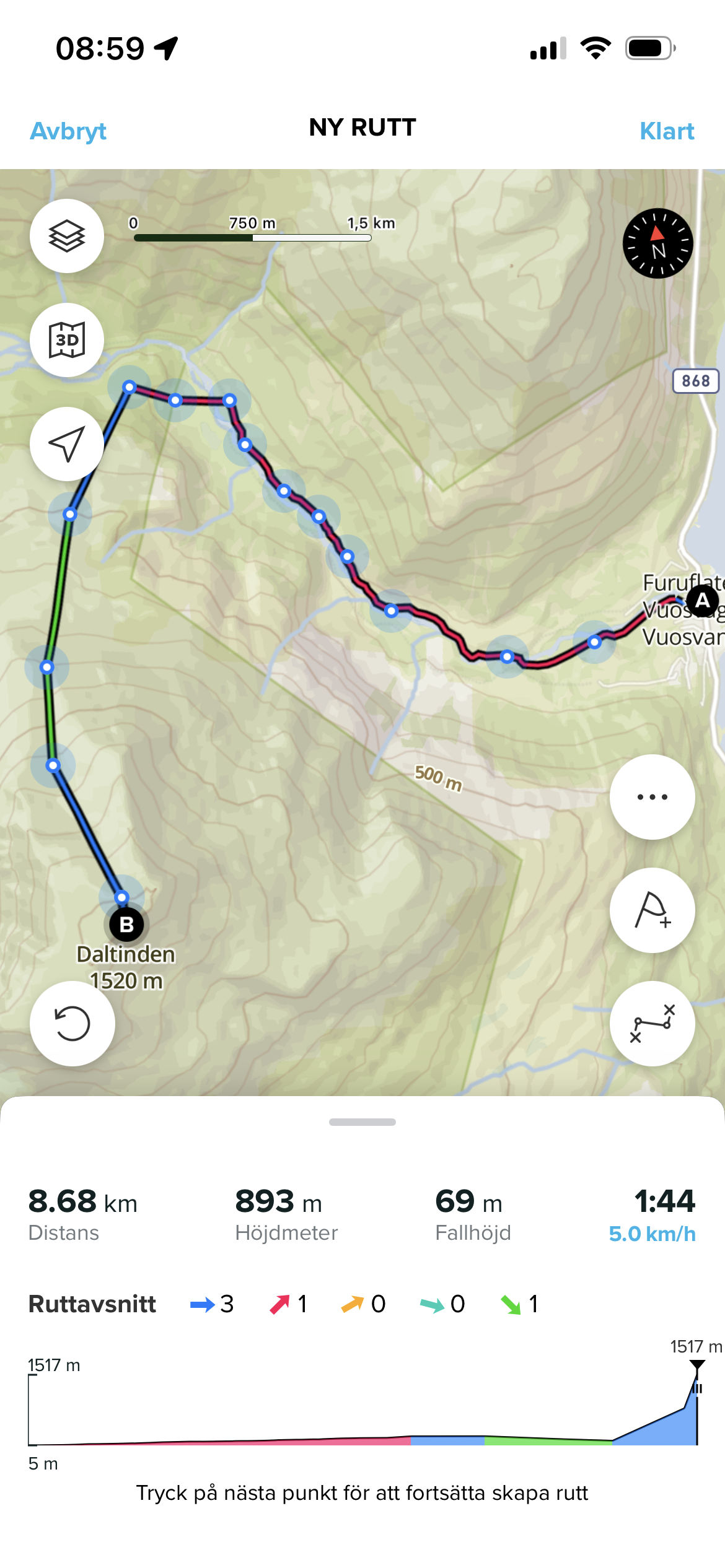
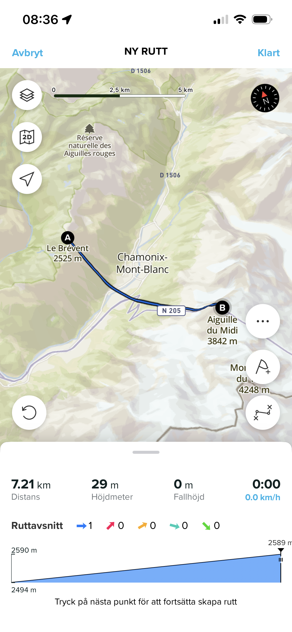
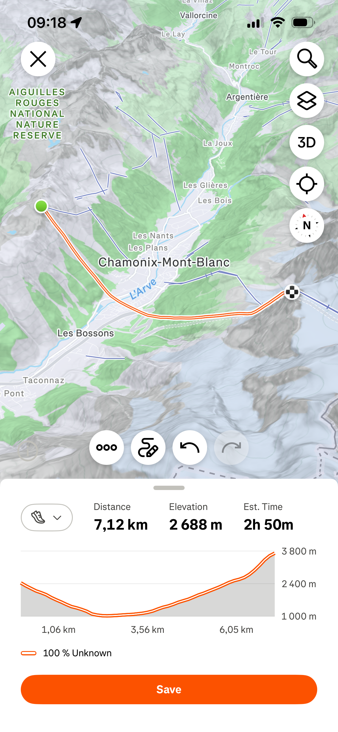
Here’s another example. Two first screenshots are from creating the same route. The only difference is that in The second picture I added the last route point at the peak, and in the first picture the last route point is slightly before the peak.
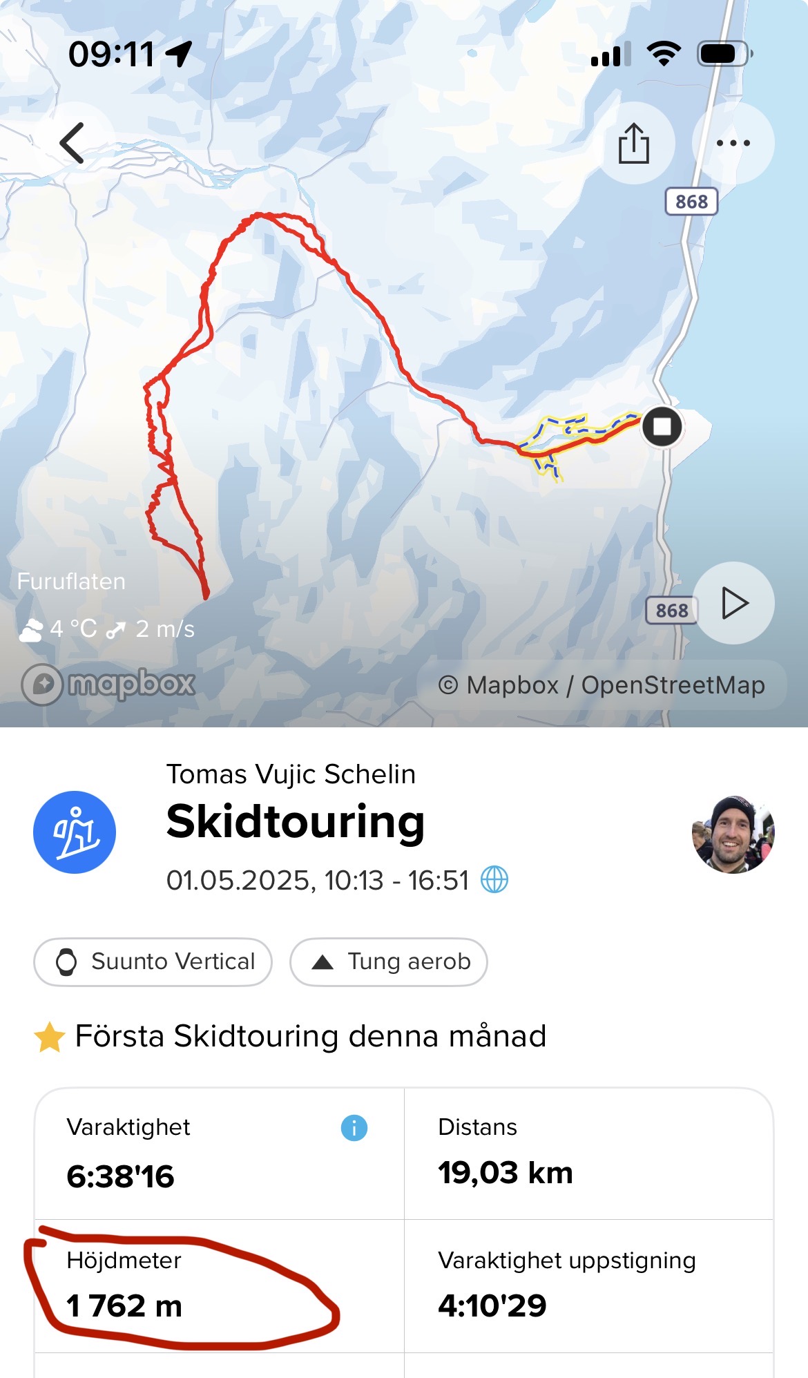
And here’s a screenshot from doing that ski tour last year.
-
And here’s and example of creating a route only consisting of point A to point B in Suunto App and in Strava. Point A is Brevant and Point B is Aguille du midi in Chamonix (France).
-
@Tomas-Vujic-Schelin said in Elevation profile of routes created in Suunto App:
I’m surprised that nobody else seems to have this isAt least from what I see in this forum?
I made several posts and comments about the low quality of elevation data in Suunto App. Even even following trails, the elevation data is often off and the estimated ascent for the route is routinely 15-30% too low.
Suunto: Ambit, Ambit 3 Peak, 9 Baro, Race S, Race Ti, Vertical 2 Ti
Garmin: Forerunner 210, Forerunner 610, Fenix 6X, Fenix 7X Ti -
I noticed the Problem on some Route creation too. Not on all routes, but on some Parts. Improving this Part of the Route creation would be pleasant.
-
@sky-runner said in Elevation profile of routes created in Suunto App:
Even even following trails, the elevation data is often off and the estimated ascent for the route is routinely 15-30% too low.
This have just become better, test again. Though ofc depends on the location
-
@Tomas-Vujic-Schelin said in Elevation profile of routes created in Suunto App:
The most obvious situation to observe the issue is when creating a manual route without following any roads or trails. The elevation profile is completely off and unusable.
When building a route in “free draw” mode the elevation is off. This is a known problem. Hopefully will be addressed one day.
-
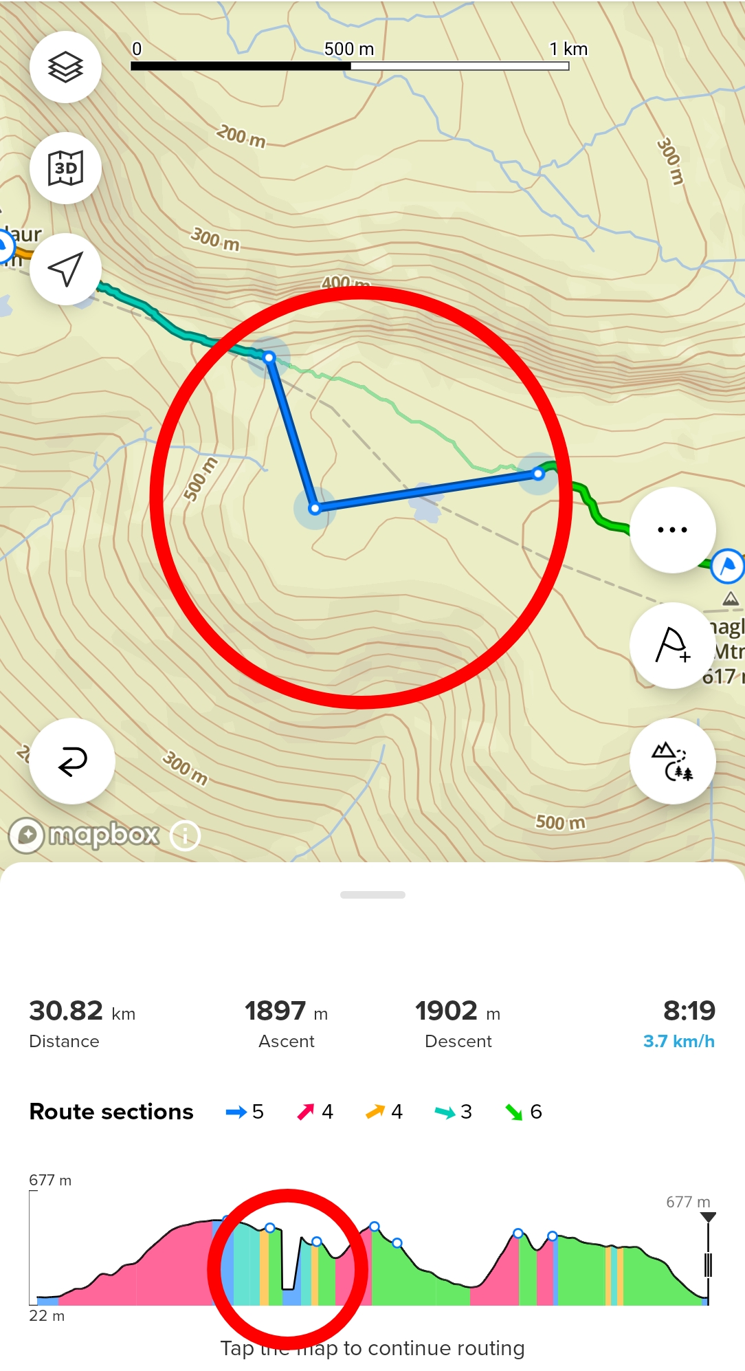
@pavel.samokha Minimal route changes, with essentially no change in elevation, result in something like this:
-
@maszop I can’t infer the full meaning from your post. What route changes?
-
@pavel.samokha Minimal route editing
-
@maszop as I said above - yes, it’s a known issue
-
@pavel.samokha Well, certain problems shouldn’t arise in tools whose primary purpose is navigation. And they’ve existed for so many years.
It’s a real shame, because I think SuuntoApp has the best route editing mechanism on the market.
-
@pavel.samokha said in Elevation profile of routes created in Suunto App:
When building a route in “free draw” mode the elevation is off.
Is there a reason behind this?
-
@2b2bff if you’re asking why SA doesn’t provide a correct elevation profile between two arbitrary points on the map then it’s because it has never been developed. This is a separate task, not the same as provide an elevation profile for a route along path network
-
@maszop said in Elevation profile of routes created in Suunto App:
Well, certain problems shouldn’t arise in tools whose primary purpose is navigation. And they’ve existed for so many years.
I’m not arguing that this is important issue to solve, but there are (and always will be) many things which someone can claim are essential.
We will soon have another big and important thing released related to navigation. -
@pavel.samokha said in Elevation profile of routes created in Suunto App:
@maszop said in Elevation profile of routes created in Suunto App:
Well, certain problems shouldn’t arise in tools whose primary purpose is navigation. And they’ve existed for so many years.
I’m not arguing that this is important issue to solve, but there are (and always will be) many things which someone can claim are essential.
A certain fairly well-known company recently added a compass to their watch – you know, to remind everyone of their navigation roots while celebrating their 90th anniversary

-
@pavel.samokha I’m just wondering whether that path has some included elevation information or the elevation is taken from the points the path goes through. I mean the map itself has clearly elevation data within as represented by those lines. So it would have been just different points…
Or is that just the visual appearance provided by mapbox?Race S
-
@pavel.samokha said in Elevation profile of routes created in Suunto App:
We will soon have another big and important thing released related to navigation.

-
@2b2bff said in Elevation profile of routes created in Suunto App:
is that just the visual appearance provided by mapbox
It is exactely that. Maps doesn’t have elevation data by themselves , but lines are build and drawn using external elevation data by the map provider.
-
@2b2bff elevation contour lines are just lines only to show elevation.
So while it is based on the source data of the same nature it’s neither the form nor the tool for the task
Hello! It looks like you're interested in this conversation, but you don't have an account yet.
Getting fed up of having to scroll through the same posts each visit? When you register for an account, you'll always come back to exactly where you were before, and choose to be notified of new replies (either via email, or push notification). You'll also be able to save bookmarks and upvote posts to show your appreciation to other community members.
With your input, this post could be even better 💗
Register Login