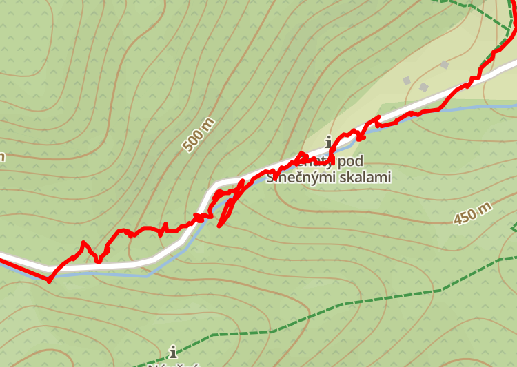
Incorrect distance when hiking
-
@tomas5 have you tried other systems too? Beidou or GPS only? Same results? How do you know the distance is off? Is it off compared to different device (ie. smartphone) or official trail?
-
@łukasz-szmigiel i tried gps only and gps + glonass. I did multiple hikes it is always more than official distance by multiple map services and it is more than my father or my wifes phone measure too. Phones are usually much more close to official route distance than suunto 5. When i opened this thread there was issue i didn’t pause while break so i was able to accept that watch measured some distance while 20min break. But now for every break i manualy paused. But still it was off. And it can be seen on map that it jumps around route instead of strait line like it supose to be.

-
And i must say that i don’t have this problem while on bike. Measuring is quite correct but i use bikepod so maybe distance is corrected by bikepod which i have calibrated quite well. I believe that with 10s fix it would be more accurate since it would be more streight but there is no such possibility and i will loose ascent and descent with 60s gps fix (endurance). So this is not a good way to fix accuracy. If snap to route would be backported from new suunto 9 to older watch it could fix this great.
-
@tomas5 one of my friend just told me that with suunto 9 he had problems too but combination GPS + galileo improved accuracy a lot. I will return to this post in few weeks with results. Hope it will improve it.
-
@tomas5 if you’re doing slow hikes you won’t loose much of ascent / descent with “good” gps mode I think. Considering that gps is poor for vertical measurements anyway (especially if signal is bad).
You may also want to try “good” gps mode and switch to navigation screen in order to trigger “best” mode for as long as long you’re on the navigation screen (as a workaround or when actually navigating).
-
@łukasz-szmigiel afaik in good GPS mode there is no altitude measurement at all in the S5…
-
@egika oh now I see - the altitude is being reported for each fix but not ascent / descent. Thanks for making it clear.
-
@łukasz-szmigiel thanks didn’t know it can be changed with navigation to better precisision. And good means 60seconds fix right? 10s fix was best for hiking with ambit but it was at cost of loosing ascent descent data. But withou baro it is not so accurate so not so important too.
-
-
@łukasz-szmigiel gps + galileo looks best. With manual pause. I did exactly same hike today as few months ago. Now distance is correct and accuracy quite good. I see zig-zag on route but it is not much and didn’t increase distance so it is ok. And even elevation and ascend descent was correct. I must say after some time i am happy with result.
Edited: i use gps + galileo
